
Live Bait Dentex Fishing
Secrets for Big Predators
Introduction: The Frustration of the "Almost" in Elite Fishing
Every offshore angler has experienced that frustrating day: you’ve spent two hours at dawn catching four live squids, your livewell is full, the sea is like glass, and your sonar marks what looks like a "golden spot." You drop your rig, the squid swims down strong, you wait for the strike... and nothing. Hours pass, and the dentex never show up.
The question in your mind is always the same: Did I choose the wrong bait? Are they just not hungry today? The reality is often much more technical and sometimes painful to accept: you weren't exactly where you thought you were.
In live bait dentex fishing, the difference between an epic day and coming home empty-handed isn't measured in miles or even meters. It's measured in inches. A GPS error of just 5 or 10 meters can mean your bait passes through "no man's land," outside the strike zone of a predator that is, by nature, extremely territorial and reluctant to move far from its cover.
The Predator's Psychology: Why Dentex Demand Such Precision
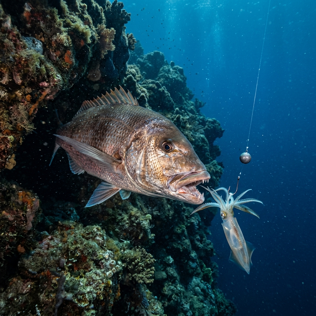
To understand why we need extreme GPS precision (< 3m), we first must understand the Dentex dentex. Unlike other tunas or pelagic predators that patrol large areas of water looking for baitfish, the dentex is an ambush hunter.
Territoriality and Ambush Points
The dentex stays in very specific structures on the seafloor. Not just any rock will do; it looks for points where the current generates small eddies that disorient small fish or where the relief allows it to camouflage perfectly before launching its lightning attack.
These "hotspots" can be:
- The bow of a sunken wreck.
- A ledge of just 1 meter in a drop-off.
- An isolated rock in the middle of a sandy area.
If you drop your bait 10 meters away from that rock, the dentex will see it, but it probably won't leave its vantage point to chase it, especially if the current is pulling the scent of the bait in the opposite direction. The dentex wants the feast to fall from the sky.
The Mathematical Tragedy of Conventional GPS Error
Many anglers blindly trust the boat icon on their screen. However, there is a technical concept that few master: DOP (Dilution of Precision) and cumulative error.
The Margin of Error in Generic Apps
Conventional map apps (like Google Maps or Apple Maps) are designed for finding a restaurant or following a road. They have a margin of error that, in marine conditions, can range from 5 to 20 meters due to the lack of land references (cell towers) and the curvature of the satellite signal over water.
The Sum of Errors: GPS + Drift + Leeway
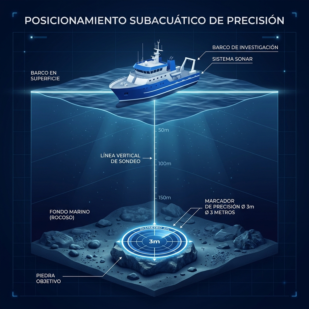
Imagine your waypoint has an error of 5 meters. Now add leeway (the effect of wind on the hull) and drift (the effect of current on the boat and line). By the time your 300g sinker reaches the bottom at 50 meters deep, the real error relative to the rock could be 15 or 20 meters.
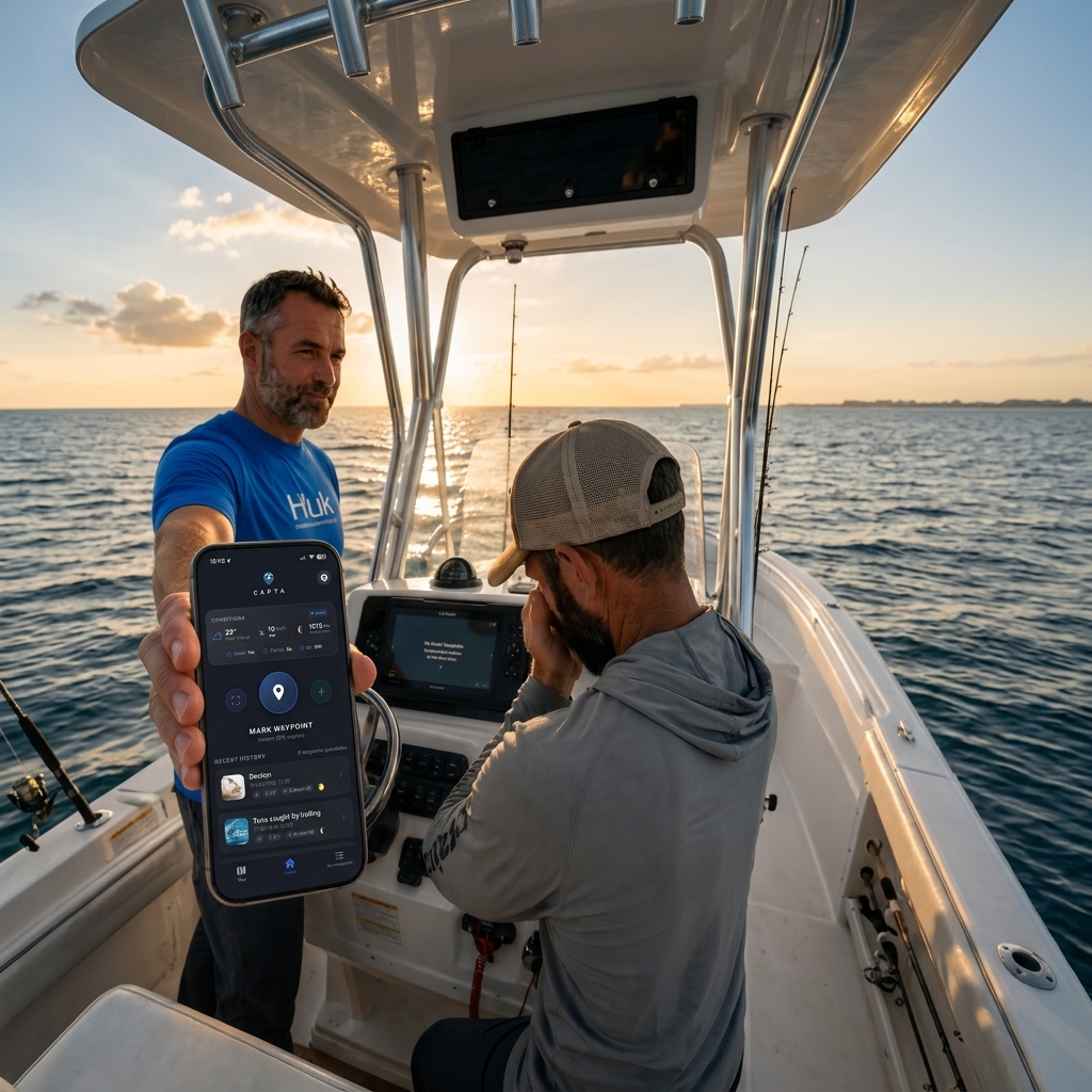
On a dentex rock, 20 meters is like being in another zip code. You are fishing in the desert while the life is happening just a few steps away. This is why CAPTA uses signal filtering algorithms to reduce the error to less than 3 meters, allowing for a surgical "vertical drop."
Boat Hardware vs. Mobile Devices: The Necessary Bridge
It's common to think: "That's what I have my $2,000 Garmin or Lowrance sonar for." And it's true, these devices are excellent for real-time navigation. But they present three critical problems that only digital management on a smartphone can solve:
- Data Fragmentation: Your best spots are trapped in physical hardware. If you sell the boat, if the equipment corrodes from salt, or if you're invited to fish on another boat, you lose your "treasure."
- Tactical Management: Organizing 500 waypoints on a 7-inch touchscreen while the boat is rocking is a logistical nightmare.
- Interface Obsolescence: Your phone has more processing power than most plotters on the market. Using CAPTA's OCR (visual scanning) to transfer the exact coordinate from the sonar to your phone allows you to have a master, portable database with precision you can consult even from your couch to plan the next trip. If you need help with this, check out our guide on how to export waypoints from plotter to mobile.
The "Zero-Meter Drop" Technique: Step by Step
To fish for dentex with extreme precision, clicking a button isn't enough. You must follow a tactical protocol:
Step 1: High-Fidelity Marking
When your sonar shows activity or a promising relief, don't settle for a generic "pin." Use the coordinate scanner to record the exact spot. Ensure your system is set to Degrees and Decimal Minutes (DDM), which is the nautical standard for precision. To master this technique, we recommend our tactical positioning guide from the boat.
Step 2: Pre-Drift Calculation
Before dropping the bait, observe where the boat drifts without the motor. If the current takes you East at 1 knot, you must position yourself West of your waypoint. Extreme precision allows you to know exactly how many meters you are from the target to decide the right moment for the "Drop!".
Step 3: Verticality Control
In live bait fishing, if the line isn't vertical, you've lost the game. Precision waypoint management allows you to see in real-time if you are moving away from the target while the sinker drops. If you move out of the 3-meter radius, it's better to reel in and start the pass again than to waste your bait's life in a barren zone.
The 4 Pillars of the Strike: Metadata Conventional GPS Forgets
A dentex fishing spot is a living entity that changes with the environment. Saving just latitude and longitude is like having someone's phone number but not knowing when to call.
A professional database for anglers should automatically record:
- Barometric Pressure (hPa): Dentex are very sensitive to pressure changes. A sudden drop usually "shuts their mouths," while stable, high pressure is usually a sign of activity.
- Moon Phase and Illumination: The moon determines the strength of the currents (spring vs. neap tides). Fishing a wreck with 2 knots of current is impossible; knowing what the moon was when you had success is the key to repeating it.
- Wind and Direction: Wind determines how the boat positions itself relative to the rock. Sometimes, dentex only attack if the bait comes from the North of the rock towards the South.
- Water Temperature: This predator's metabolism accelerates with warm water but it seeks depth when the surface heat becomes too much.
Information Sovereignty: Protect Your "Golden Spot"
This is perhaps the most important point for the veteran angler. The fishing community is, by nature, protective of its secrets. And for good reason: a dentex hotspot can take years to find and only a few days to be overfished if the location becomes public.
The Danger of Social Apps
There are apps that offer free "community maps." The price you pay is your privacy. By using those apps, your spots are analyzed by algorithms that create heatmaps for other users. At CAPTA, we defend the Anti-Social Philosophy. Your spots are yours, encrypted locally, and never feed public databases. What you catch on your boat stays on your phone.
Conclusion: Excellence is Not Optional
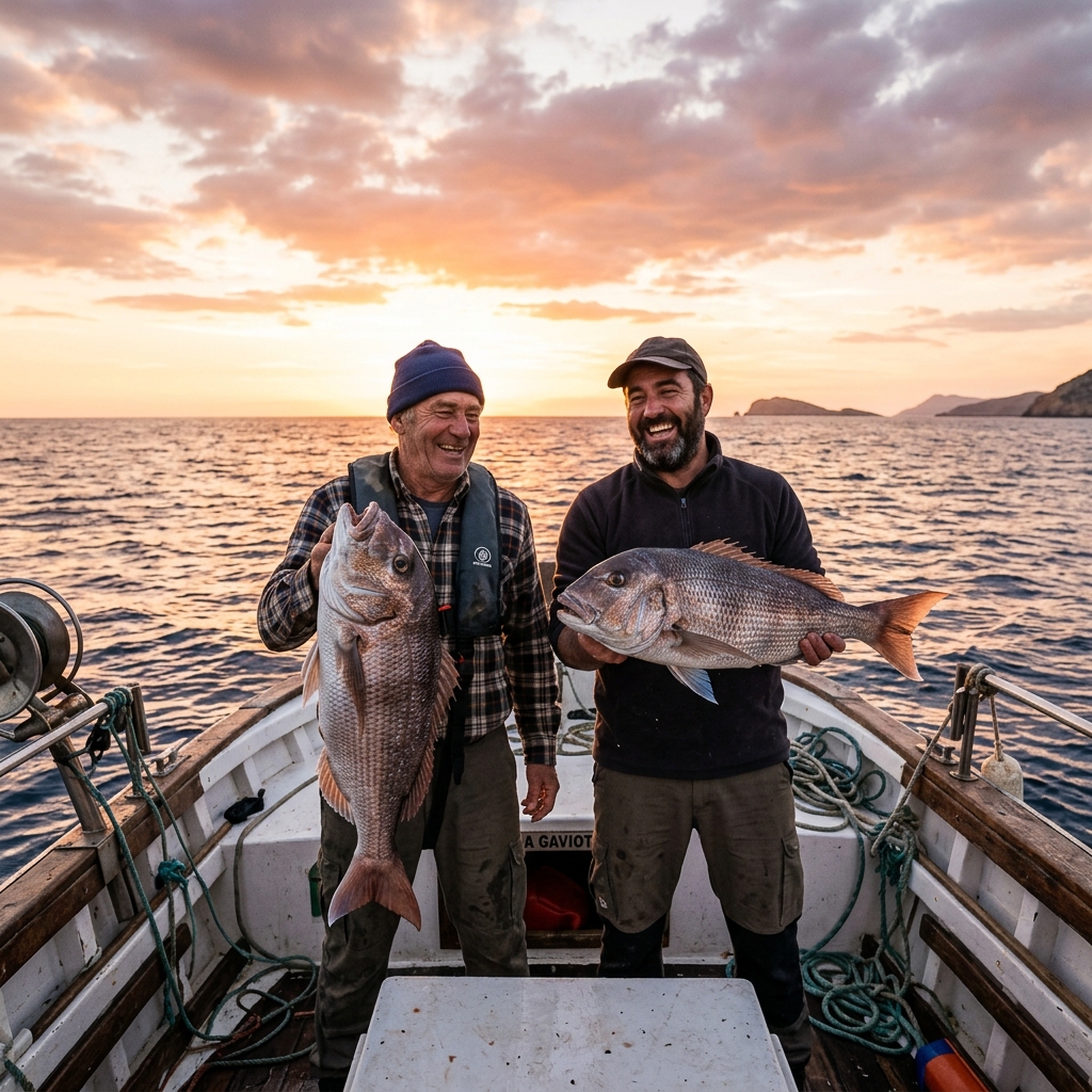
Live bait dentex fishing is a discipline that rewards rigor. From hook choice to bait freshness, everything must be perfect. But it's no use having the best squid in the Mediterranean if you are presenting it in a desert 15 meters away from the rock where the fish are.
Extreme precision (< 3m) is the tool that allows you to remove the luck factor from the equation. Don't look for excuses in the moon or the bait; first ensure you are exactly in the right spot. Because at sea, being "close" is the same as being nowhere. If you want to see a real success story, don't miss our guide on live bait dentex fishing and GPS precision.
Frequently Asked Questions (FAQ) about Dentex Fishing and GPS
What is the real precision of a smartphone GPS compared to a nautical plotter?
Modern smartphones use dual-band GNSS (L1+L5) systems that, in open spaces like the sea, can offer a precision of 2 to 4 meters. This is equivalent to or even better than many mid-range commercial plotters, which often rely on external antennas with slower communication protocols.
Why does my sonar show fish but they won't bite the live bait?
There could be two reasons: either you aren't passing the bait through their exact strike zone due to line drift (lack of vertical precision), or the fish are inactive due to barometric factors. Recording pressure metadata for each trip will help you solve this mystery.
Can I organize my dentex spots by depth?
It is highly recommended. A good organization by folders (e.g., "Dentex 30-40m", "Winter Dentex 60m+") allows you to decide which area to attack according to water temperature and the time of year in seconds.
Can I transfer my points from my old sonar to my phone accurately?
Yes. Using technologies like CAPTA's OCR (visual scanning), you can scan GPS coordinates from a photo to capture the exact position from your Garmin, Lowrance, or Simrad sonar and have it on your phone with sub-meter precision instantly.
Is it safe to save my best marks in a mobile app?
Only if the app guarantees data sovereignty. Ensure the app you use doesn't share locations in an aggregated way and allows for private backups (GPX export) so you are always the owner of your information.