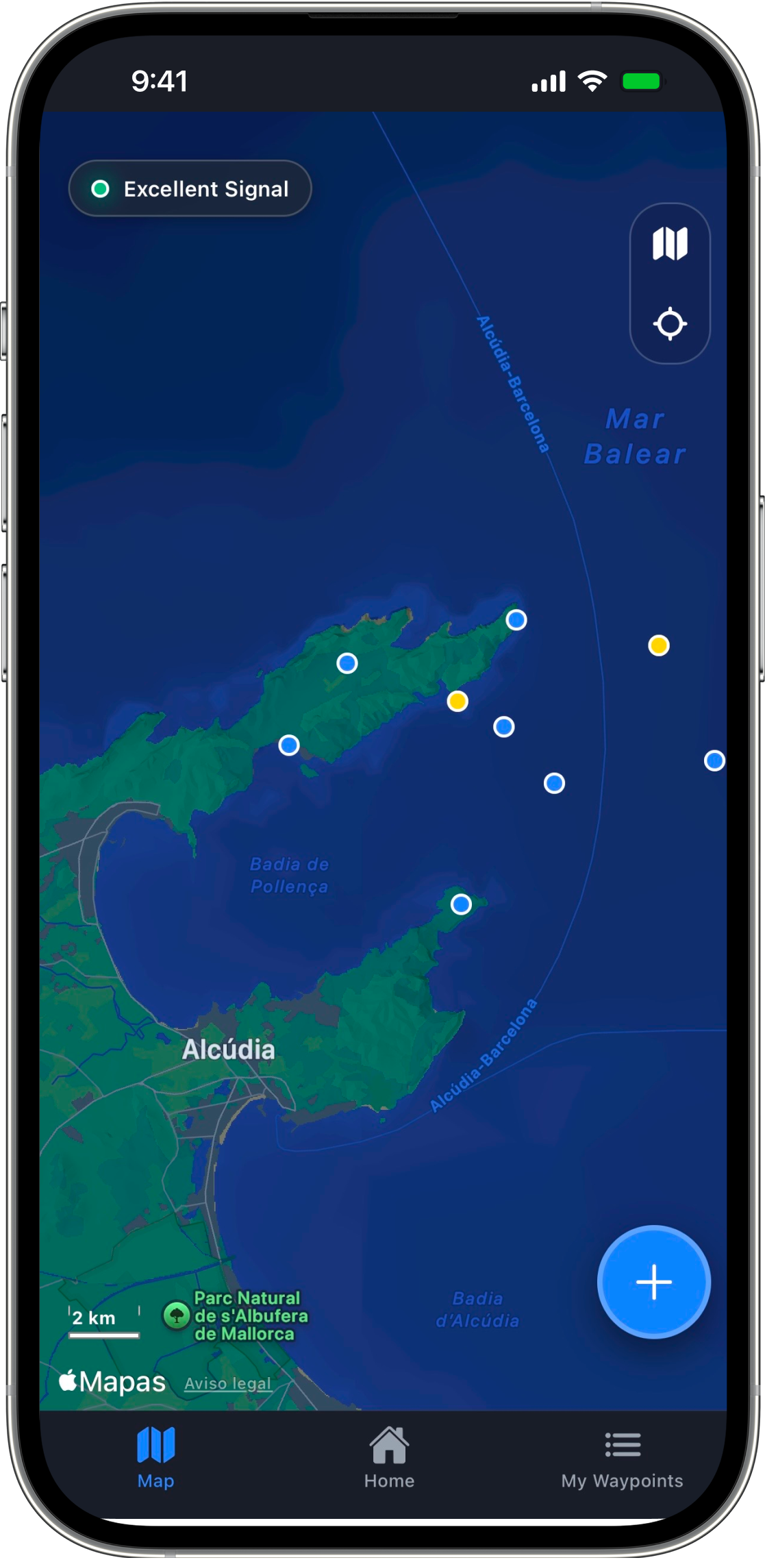
CAPTA Logo

Capture.
Save.
Navigate.

The app to save waypoints fast, no menus, no noise. Designed for when time and precision matter.

App Screenshot

5.0 rating on the App Store

Designed to capture locations instantly

The fastest way to save and organize GPS coordinates.
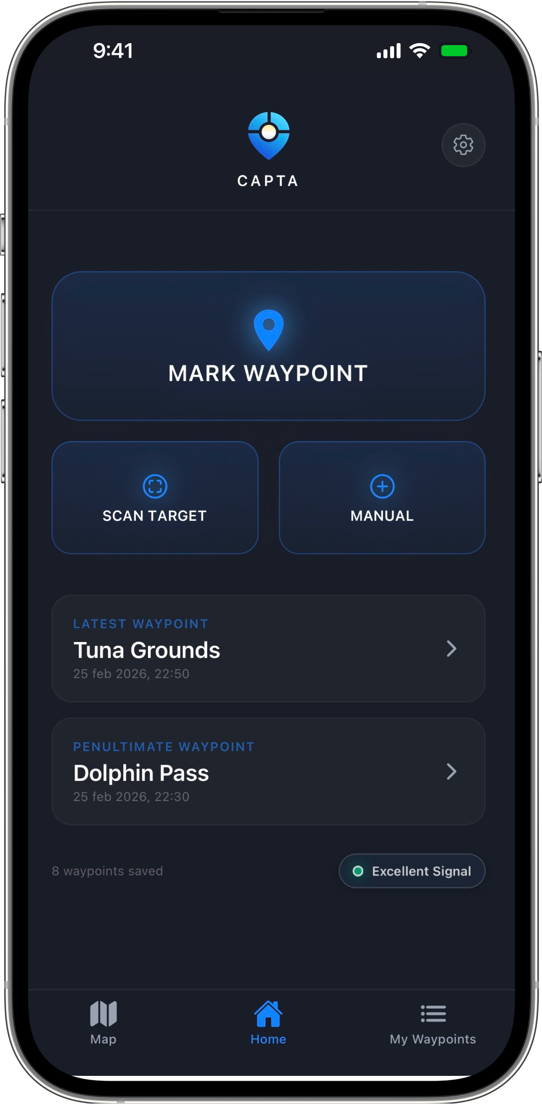
Instant Saving

Capture your current location with a single tap, no unnecessary steps.

Simple & Direct Flow

A clean and straightforward interface for saving and managing your locations.

Precise GPS

The best possible latency from your device, ideal for open sea, mountains, or any environment.

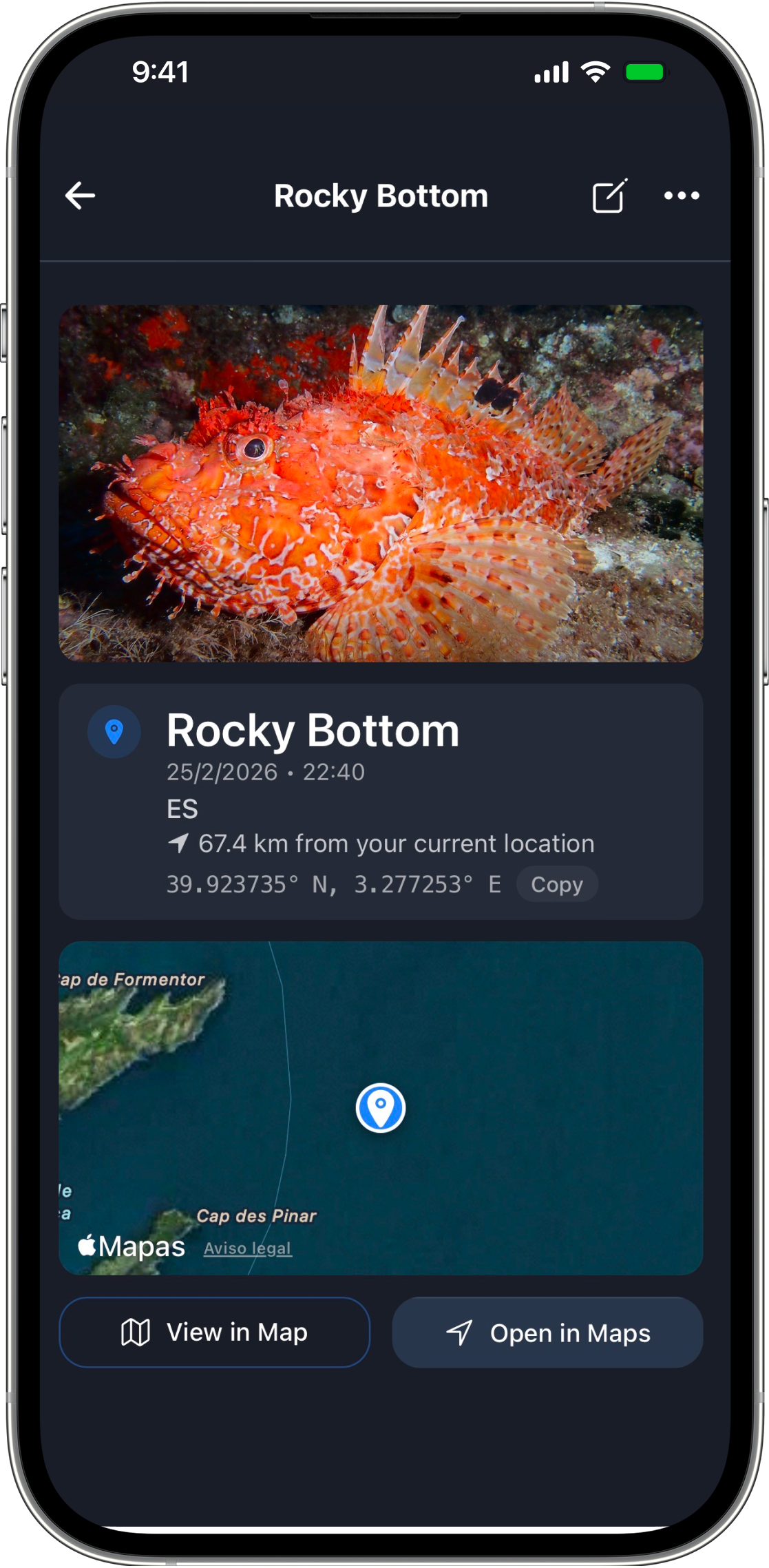
Capture coordinates with camera

Point and save coordinates directly from the viewfinder. You'll know exactly which spot it is.

Works Offline

Save and view locations even without coverage. Ideal for exploration and remote environments.

Cloud Sync

Access your locations from any device. Everything stays synced automatically.

Three steps to your destination

A refined process so you can keep your attention on the terrain, not the screen.

01

Mark your position

Save a point however you prefer: current location, manually, or using the camera.

Mark your position
02

Add context

Include a photo, name, or note to remember exactly that place.
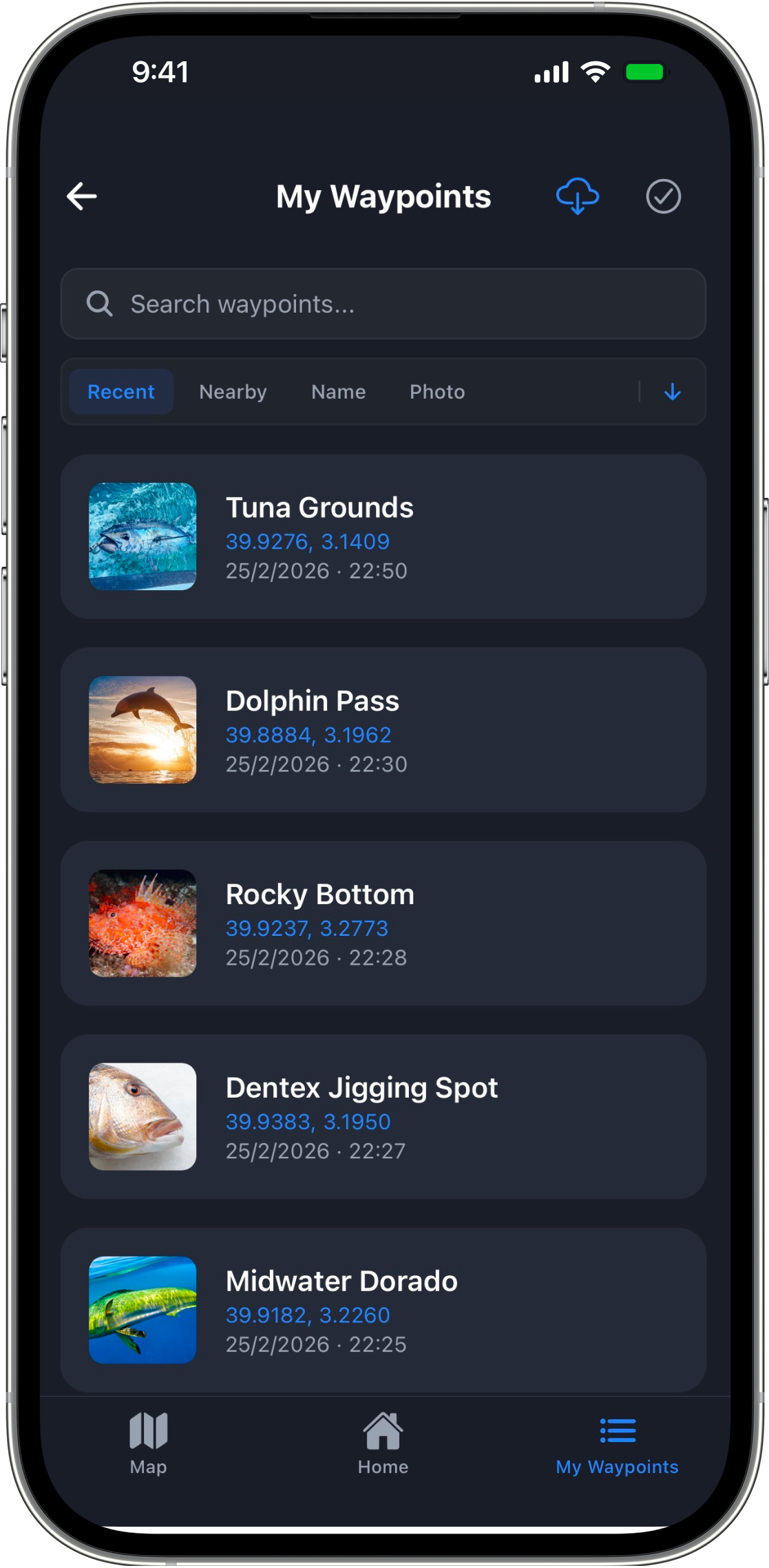
Add context
03

Find it anytime

Access all your saved points and navigate back to them easily.

Find it anytime

Designed for exploring

FishingSave your best spots and return to them with precision.
HikingMark key points on your route and never lose your way.
PhotographySave unique locations to return at the perfect moment.
ProfessionalsMark important locations without wasting time.

Your data is yours. Always.

We don’t track your activity or sell your data. Your locations are saved just for you, and if you use an account, they sync securely between your devices.

Read our privacy policy

Frequently Asked Questions

No, CAPTA is designed to work 100% offline and without coverage. Your smartphone's GPS sensor is independent of the mobile data network or WiFi, allowing you to save waypoints and navigate in open sea or high mountains where other map tools fail.
Your data is saved locally for maximum privacy. Only if you decide to create a free account, your waypoints will be securely synced in the cloud, allowing you to access your locations from any iOS or Android device with total security.
Yes, CAPTA allows you to export your waypoints in GPX format, the universal standard for GPS. This makes them 100% compatible with Garmin, Google Earth, Navionics, and other professional nautical or mountain navigation applications.
If you use a CAPTA account, your data is safe. When you log in to your new phone, all your points, photos, and notes will be downloaded automatically. Sync is bidirectional between iPhone and Android devices.
You can download and use the current version of CAPTA for free. Our commitment is to always maintain a robust and functional free plan for the community of explorers, fishermen, and adventurers.
We are at your disposal at getcapta@gmail.com or through our social networks. We attend to technical queries, suggestions for new features, and doubts about the use of GPS in a personalized and fast way.
CAPTA is optimized for low battery consumption on long expeditions. Our intelligent GPS system only activates high-precision search at the instant of capturing the point, avoiding unnecessary energy drain during your journeys.
CAPTA offers the maximum precision allowed by your device's hardware. In open-sky conditions (sea or mountain), we achieve a precision of a few meters, ideal for marking fishing spots or exact milestones on remote trails.
Absolutely. Privacy is our fundamental pillar: your locations are yours and only yours. We do not track your activity, we do not sell data to third parties, and we do not have access to your private points unless you decide to share them.

Ready for your next adventure?

Download CAPTA for free today and start saving your best spots with the precision and speed you need.