Master Guide for Saving GPS Fishing Spots
The Professional CAPTA System
Technical Management of Fishing Spots: The Professional GNSS Ecosystem
In modern professional and sport fishing, the difference between a successful outing and returning to port empty-handed doesn't rely solely on the quality of the tackle or the angler's skill. The determining factor is geographical information management. A fishing spot is not just a coordinate on a screen; it is a temporal and spatial record containing the DNA of an epic strike.
Relying on human memory for visual landmarks or, worse, delegating this responsibility to mass-market applications with tracking algorithms, is the most critical mistake an angler can make. CAPTA was created to professionalize this workflow, transforming the smartphone into a high-fidelity geodata storage unit, shielded against data loss and digital espionage.
The Science of Location: GNSS vs. Generic GPS
To understand why CAPTA is the definitive solution, we must delve into the mechanics of localization. While we colloquially speak of GPS, the technical reality is GNSS (Global Navigation Satellite Systems). Modern smartphones do not just "listen" to the American GPS network, but also to the European Galileo, the Russian GLONASS, and the Chinese BeiDou.
The Challenge of the Marine Environment
At sea, the angler faces multi-path interference. The satellite signal reflects off the water surface before reaching the mobile sensor, creating positioning errors that can shift a waypoint by several meters. A displacement of just 5 meters can mean being off a submerged rock or a critical current channel. CAPTA uses filtering algorithms that prioritize signals with the best signal-to-noise ratio, ensuring that when you mark a spot, you are saving the exact epicenter of the structure.
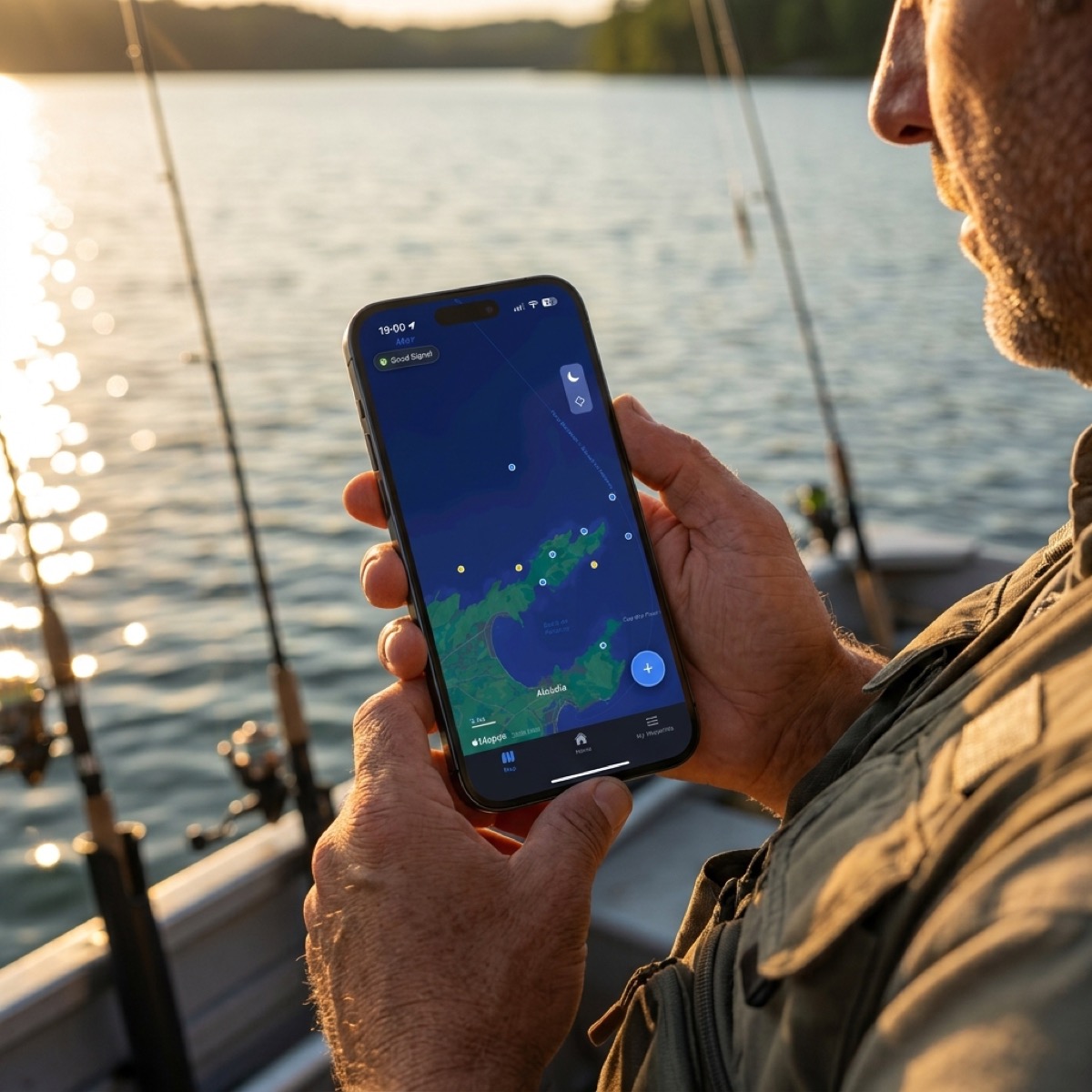
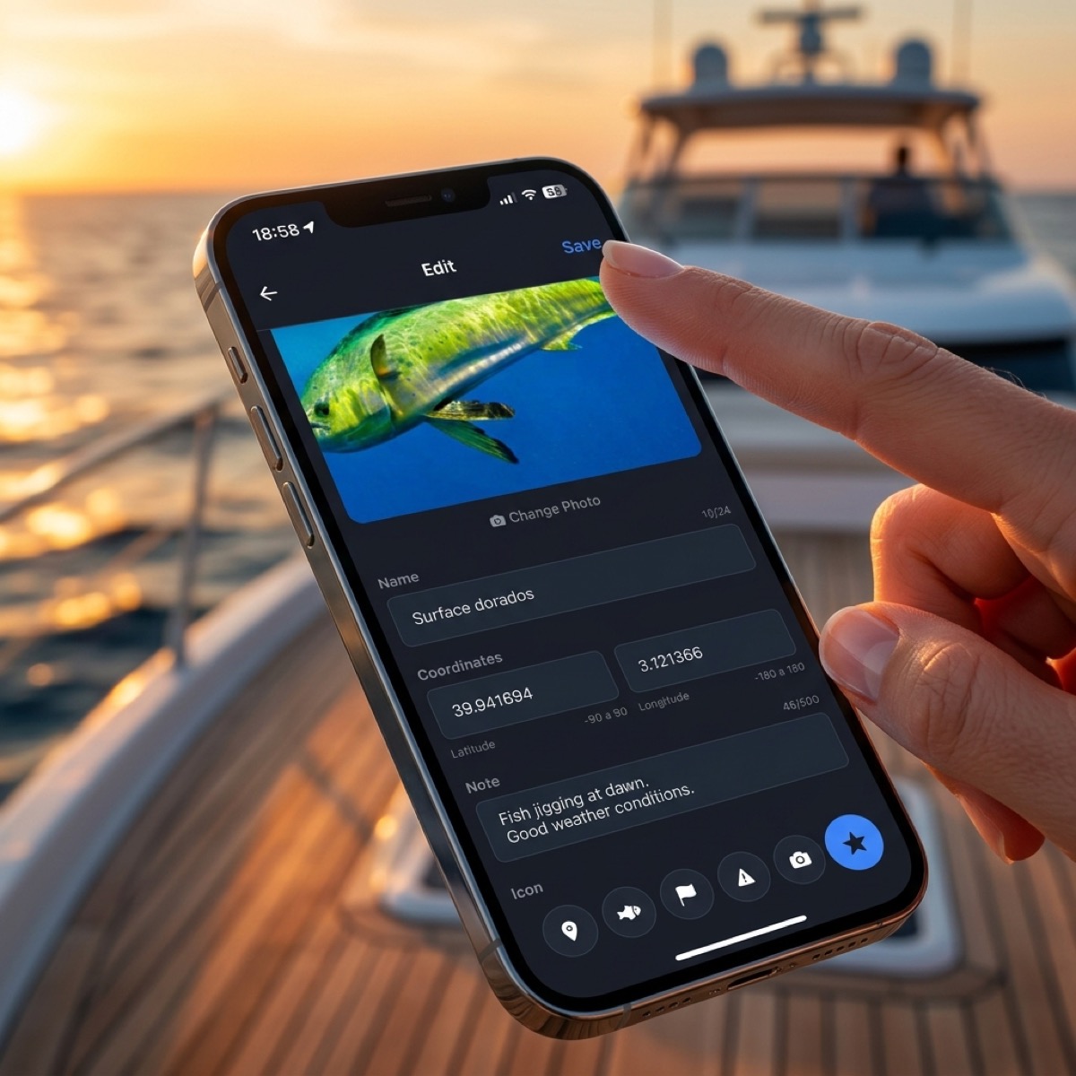
The Live Waypoint: Beyond Latitude and Longitude
A fishing spot saved without context is sterile data. In specialized fishing, the "when" and "how" are as important as the "where." CAPTA revolutionizes spot saving through Automatic Environmental Metadata Injection.
When the angler presses the capture button, CAPTA doesn't just freeze the coordinate; it performs an instantaneous query to hydrological weather stations to record:
- Barometric Pressure (hPa): Crucial for understanding the swim bladder activity of predators.
- Wind Vectors: Speed and direction, factors that determine boat leeway and drift.
- Lunar Phase and Tides: Critical data for estuary and intertidal fishing.
By transforming a simple mark into a complete technical record, the angler can perform Catch Archaeology months later, identifying patterns that were previously invisible to the naked eye.
Security Risks and Data Sovereignty
There is an uncomfortable reality in the world of map applications: Your secret spots are the product. Many free applications or fishing social networks analyze your coordinates to identify "hotspots" and sell that aggregated information or use it to train geographic indexing models.
CAPTA: Your Private Black Box
Information sovereignty is a fundamental pillar of our solution. CAPTA has been designed under the principle of Privacy by Design. Your fishing coordinates:
- Are not shared with public clouds for market analysis.
- Are not trackable by other users through "discovery" features.
- Live in an encrypted environment that only you can access.
In a world where access to information is total, keeping a spot's secret is the greatest competitive advantage an angler can possess. CAPTA is the sanctuary of that secret.
Interoperability with Nautical-Grade Electronics
A professional angler usually alternates between several devices: their Lowrance, Garmin, or Simrad plotter on the boat, and their smartphone on land. CAPTA doesn't seek to compete with the sonar unit, but to complement it and serve as the data logistics center.
Thanks to compatibility with the GPX (GPS Exchange Format), CAPTA allows for a bidirectional workflow. You can mark spots from the shore or while exploring a new area in a rental boat, and then export those data to load into your main boat's navigation system. This eliminates information fragmentation; no more spots on the plotter and spots on the phone, but a single centralized and secure master database.
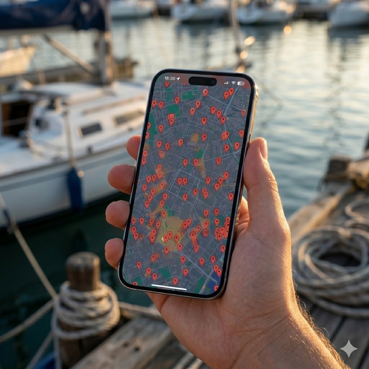
The Taxonomy of Success: Advanced Organization and Filters
Having 1,000 disorganized fishing spots is equivalent to having none. The visual chaos on a small screen prevents quick decision-making during frantic activity (the "feeding frenzy").
CAPTA introduces an advanced Waypoint Taxonomy that allows for organizing knowledge through:
- Species Layers: Filter your map to see only the rock reefs where Snapper entered last year.
- Technical Seasons: Separate summer and winter spots to visualize how biomass shifts in your usual fishing area.
- Activity Status: Mark "transit," "feeding," or "shelter" zones, creating a strategic map that goes far beyond a simple list of coordinates.
Digitalizing Legacies: From Notebook to GNSS
Many veteran anglers possess treasures in the form of coordinates jotted down in old notebooks or paper nautical charts. The risk of physical loss due to humidity, fire, or simply being misplaced is extremely high.
CAPTA facilitates the digital transition through its manual import and scanning tools. By digitalizing these legacies, you not only protect them from the passage of time but grant them superpowers: a spot noted in 1995 can now be navigated with the precision of a latest-generation satellite and visualized over high-resolution satellite orthophotos.
FAQ: Frequently Asked Questions About Fishing Spot Management (Faq)
How does high-precision GPS usage affect my phone's battery during 8 hours of fishing?
CAPTA has been designed with a low-impact energy management engine that only activates high-fidelity sensors during the micro-moments of waypoint capture. Unlike turn-by-turn navigation apps that keep the GNSS receiver in a constant refresh cycle, CAPTA minimizes resource consumption, allowing your device's battery to last for full days even in areas of low coverage where consumption usually spikes. This establishes CAPTA as the most efficient solution for the long-distance angler.
Can I use CAPTA to mark spots in open sea areas without mobile data coverage?
Absolutely. CAPTA's architecture allows for total "offline" operation. Positioning is done through direct satellite signals that do not depend on the telephone network. The system stores coordinates locally and, once the device recovers an internet connection back at port or via a satellite network, it synchronizes and enriches the waypoints with the history of environmental metadata collected during the outing. This makes CAPTA an infallible data survival tool in the ocean.
What is the real precision difference between CAPTA and marking a spot on Google Maps?
The difference is critical for precision fishing. While Google Maps uses algorithms optimized for urban planning and the road network (A-GPS), CAPTA directly accesses the hardware's raw positioning protocols, eliminating the route smoothing that conventional map apps often apply. This translates to a drastic reduction in approximation error, allowing you to return exactly to the detected rock or wreck, thus optimizing fishing time and avoiding fuel waste.
What export formats does CAPTA support for use in plotters from brands such as Garmin or Lowrance?
The system is fully compatible with the industrial GPX standard, which is the universal language of nautical navigation. This means you can move your CAPTA data to any professional terminal (Garmin, Furuno, Lowrance, Humminbird) without loss of fidelity. Furthermore, we offer support for KML and CSV formats for those anglers wishing to perform advanced catch analysis through desktop software or customized Geographic Information Systems (GIS).
Conclusion: The Data Angler is the Winning Angler
Fishing has ceased to be solely a duel between man and fish to become an information management competition. The angler who masters their marks, understands their metadata, and protects their privacy, is the one who achieves consistent results season after season.
CAPTA is not just an application; it is your nautical intelligence companion. It is the system that ensures every drop of fuel spent and every hour invested in exploration is transformed into a permanent and secure digital asset.
Start building your map of success today and stop relying on luck or memory.