The 5 Mistakes That Give Away Your Secret Fishing Spot on Social Media
Introduction: The Incalculable Value of a Secret Spot
In the world of sport fishing, few things hold as much value as information. Finding that sunken wreck, that isolated rock holding baitfish, or that steep drop-off of the seabed is no accident.
It is the result of:
- Hundreds of hours of navigation.
- Thousands of liters of burned fuel exploring the ocean.
- An obsessive dedication to reading the sea, interpreting currents, and understanding fish behavior.
However, in the era of hyperconnectivity, all that titanic effort can vanish in seconds. A single post on social media, a slip in a forum, or a WhatsApp message to the wrong person can be enough for dozens of boats to flood your secret spot the following weekend. The sea belongs to everyone, but the prospecting work is yours, and protecting it is your right.
The irony is that anglers rarely reveal their coordinates intentionally. The problem lies in passive information leakage. Current technology allows keen observers to extract precise data from details that most of us overlook in the euphoria of the moment.
If you want to keep your fishing areas under the radar and ensure that your catches remain yours season after season, you must secure your digital footprint.
Below, we deeply analyze the five critical mistakes that are giving away your best fishing spots without you realizing it, and how modern technology can help you protect them.
1. Fishing Photos with Recognizable Coastal Backgrounds: The Danger of Visual Triangulation
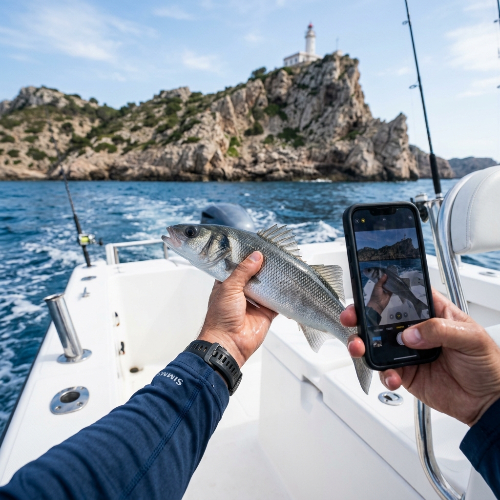
The oldest error and, surprisingly, the most frequent. You've landed the catch of the season, adrenaline is pumping, and you pull out your phone to immortalize the moment. The fish looks spectacular in the foreground, but right behind you, the coast appears sharply.
A distant lighthouse, the peculiar silhouette of a mountain, a telecom antenna, or even a specific alignment of two buildings in the distance. To the untrained eye, it's just a landscape; to an experienced local angler, it's a treasure map.
A seadog's mind works like a bearing compass.
- If your photo shows "Peak X" aligned with "Cove Y," someone who knows the area can draw two imaginary bearing lines on their nautical chart. The point where they cross is your boat.
- Add to this the analysis of water depth by its color (the dark blue of the drop-off versus the turquoise of the sandbank).
- Or the direction of the swell and the breaking foam, which betray specific currents.
How to avoid it: The golden rule is to photograph facing the open sea, where the horizon offers no landmarks. If you are fishing very close to the coast, at a river mouth, or in an enclosed lake, photograph the catch pointing towards the boat's floor (the deck). Also, use your smartphone's portrait mode to aggressively blur the background.
2. EXIF Metadata in Fishing Photos: How They Reveal Your GPS Coordinates
This is undoubtedly the most severe cybersecurity flaw anglers commit in the digital age. Every time you take a picture with your smartphone, the camera doesn't just capture the visible image; it embeds a hidden data file called EXIF (Exchangeable Image File Format).
This file contains technical information about the lens, the exact time, and, if you have location services enabled, the exact GPS coordinates of latitude and longitude where the photo was taken with a margin of error of just a few meters.
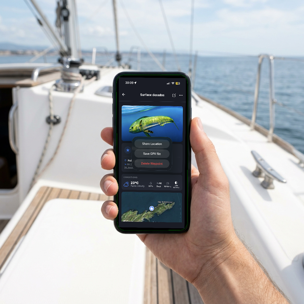
When you send the original photo via email, AirDrop, or upload it to certain older fishing forums that do not optimize images, those metadata travel intact with the photo. Anyone downloading the image can right-click, view the file's "Info," and get the exact pin of your waypoint.
How to avoid it: Turn off location tracking in your phone's native camera, but this will prevent you from remembering where you took personal photos. The professional solution is to use secure waypoint capture tools. This is similar to the security risks we explain in our guide on how to save fishing points from the boat securely. With CAPTA, your photos of the day are taken directly within the application and saved with their geographical context 100% locally and isolated. This way you maintain a perfect visual record for your logbook, without the risk of the photo ending up in your public gallery with exposed metadata.
3. Showing Your Fish Finder or GPS Plotter in the Background of Your Photos
It's a classic scenario: you take a picture of the catch in the boat's cockpit, and in the background, the steering console clearly shows the illuminated screen of your multifunction display or your Lowrance, Garmin, Raymarine, or Simrad plotter.
This is a doubly lethal error that gives away years of experience in a single click:
- Coordinates in plain sight: The screen usually permanently displays your current GPS coordinates in the top corner. Modern AI image enhancement tools can recover those numbers even if the original photo is pixelated or blurry.
- The bottom relief: If your sonar is showing the bathymetric chart, you are giving away the underwater topography. The depth contour lines and the shape of the drop-off are like a fingerprint of your secret zone. A dedicated angler will spend hours scanning their own Navionics chart until they find the exact relief that matches your photo.
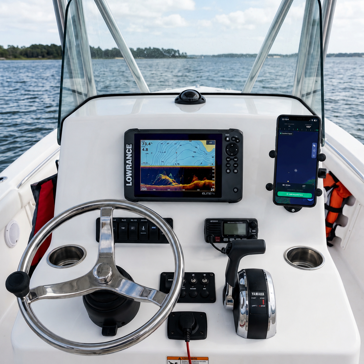
How to avoid it: Prevention is your best ally. Turn off the screens or put them in standby mode when you are going to do a photo session after a good bite. If you forgot to do it in the euphoria of the moment, assume the photo is compromised and aggressively crop it before sharing it. If you need to organize and transfer your navigation data, we recommend reading our article on how to export waypoints from the boat plotter to mobile without compromising your marks.
4. Sharing Too Much Detail on Tides, Depth, or Fishing Lures
Sometimes, the image is perfectly safe. There is no visible coast, no metadata, and the sonar was off. However, the text accompanying the image on Facebook or Instagram is the problem. In our eagerness to tell the epic story of the catch, we provide too many pieces of the puzzle to our competitors:
"Incredible bite at 18:30, just at the turn of the low tide, fishing at 45 meters depth on a rocky drop-off, using a 120-gram chartreuse jig, a couple of miles from the south port entrance."
You've just given away your complete fishing pattern. You have given the audience:
- The exact depth of the activity zone (45m).
- The type of structure (rocky drop-off).
- The technique and lure that are working.
- The exact moment of the tide and the time of day.
- A limited action radius (a couple of miles from the south port).
A good local angler doesn't need your exact coordinates if you give them this master formula. They will simply navigate to that radius, look for the 45-meter bathymetric line with a rocky bottom on their chart, and replicate your tide and lure conditions.
How to avoid it:Be intentionally ambiguous. The fishing narrative doesn't need to be an expert report. Keep technical details, exact depths, and tide moments locked away. Your personal database is the only place where you should record water temperature, moon phase, and the winning lure.
5. Social Fishing Apps and the Trap of the Shared Heatmap
This is the most insidious and dangerous error of all, primarily because it happens in the background and automatically. Leading mass-market mapping applications, like Navionics, as well as certain sport fishing social networks (like Fishbrain), base much of their business model on crowdsourcing or massive community data collection.
When you navigate, prospect, and fish with these active applications (especially if you use features like SonarChart Live), you are constantly sending your sonar information and trajectories to the parent company's servers. Your repetitive routes over a specific area and your prolonged stops feed a global heatmap.
Even if you never explicitly publish a waypoint or share a photo, the app's algorithms interpret that that area, which previously looked like a desert on the map, is actually a point of very high interest. The result is devastating: in the next community update of the nautical chart, the relief of your secret zone becomes ultra-detailed and visible on everyone else's plotters. You've worked for free to map the seabed for your competition.
6. CAPTA: The Private Fishing App to Keep Your Waypoints Secret
Faced with the constant threat of information leakage, the professional angler and advanced enthusiast need to completely detach from the "community" concept to protect their marks. Your hours at sea are worth money and sacrifice, and your technological tools should reflect that value.
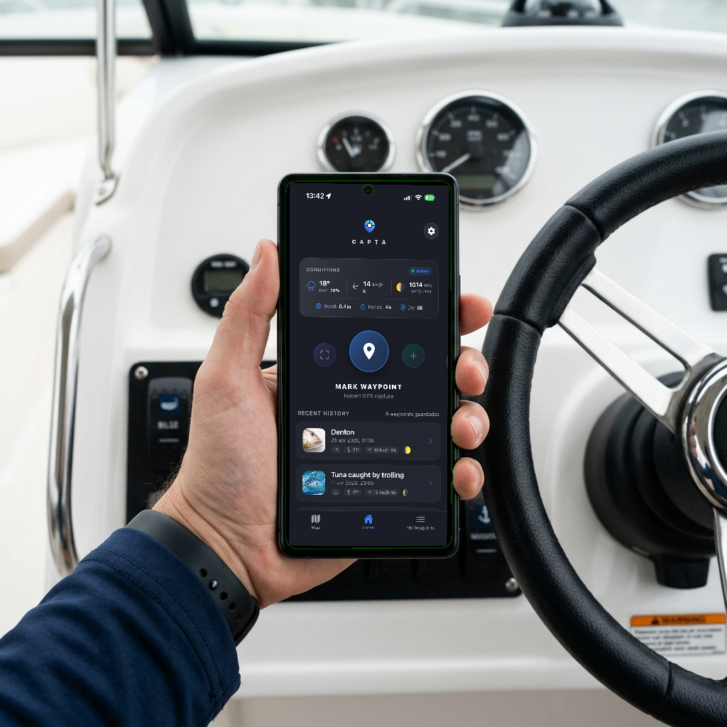
This is where specialized applications like CAPTA change the game. CAPTA is not a social network, nor a collaborative map; it is a digital safe designed exclusively for professional waypoint management.
Why are elite anglers migrating to CAPTA's "Anti-Social" philosophy?
- Extreme Privacy (Offline-First): The information you generate is strictly yours. CAPTA stores your entire database locally on your device. There are no heatmaps, no servers analyzing your routes, and no data sharing to improve third-party charts. What happens on your boat, stays on your phone.
- Fast Capture via OCR: For instance, if you have old photos with visible coordinates on screen, you can use our technology to scan GPS coordinates from a photo in a few seconds completely privately. Furthermore, instead of manually typing coordinates on your mobile (which takes time and attracts prying eyes in the port), CAPTA uses visual recognition technology (OCR). You simply point the camera at the screen of your Lowrance, Garmin, or Simrad sonar, and the app instantly extracts and saves the coordinates privately and error-free.
- Automatic Context without Risks: When saving a waypoint, CAPTA automatically attaches the exact weather conditions of the moment (wind, atmospheric pressure, moon phase) without you having to reveal it in Instagram descriptions. You will have the perfect pattern, but only for you.
- Professional Organization: Replace the old and vulnerable paper notebook (which can be lost, get wet, or be browsed by anyone) with an encrypted system where each spot has its private notes, its secure photos (without public EXIF), and its exact coordinates ready to navigate back to.
Conclusion: Silence is Your Best Tackle
Protecting your work at sea today is as important as knowing how to tie a good knot, choosing the right fluorocarbon, or sharpening your hooks. In the 21st century, the angler not only fights against the elements and the fish but against digital overexposure.
Check your backgrounds before taking a photo, obsessively control your metadata, turn off your screens when you take out the camera, carefully measure your words on networks, and above all, choose technological tools that respect your privacy and defend the sovereignty of your data. The sea always rewards those who work hard, but only those who know how to be discreet manage to keep their treasures season after season.
Frequently Asked Questions
Is it safe to send fishing photos via WhatsApp or Telegram to my buddies?
WhatsApp compresses images and removes EXIF metadata by default when sending them as a standard image. However, if you send the photo using the "Document" or "File" option (very common when we want to keep the high resolution of the original image), the metadata remains intact and the exact location can be easily extracted. The safest thing is to disable the location in your mobile's camera for catch photos, or use the secure internal camera of applications like CAPTA.
Can they discover my fishing marks just by seeing the coast in the photo?
Absolutely. Experienced local anglers master the technique of visual triangulation. If two landmarks on the coast appear in your photo (like a particular cliff and a distant building), it is relatively easy to draw bearing lines on a traditional or digital nautical chart and determine your exact position through the intersection of both lines.
Do Navionics or other similar apps share my secret fishing zones with other users?
If you have community synchronization features or automatic sonar log uploads (like SonarChart Live) enabled, your navigation routes and your highest sonar activity zones are sent to their servers and used to update the bathymetric charts of all users worldwide. Even if the app doesn't share the pin or the name of your "exact point," it reveals the topography and relief of your secret zones to all your local competition.
How does CAPTA protect the privacy of my waypoints compared to other applications?
CAPTA is designed from the ground up with a strict "Anti-Social" philosophy. The application does not track your routes to create global heatmaps, completely lacks community features, and does not share your sonar logs with absolutely anyone. Your waypoints, photographs, and private notes are saved locally in the memory of your device or in your own private cloud, guaranteeing that you and only you have total control over your fishing information.