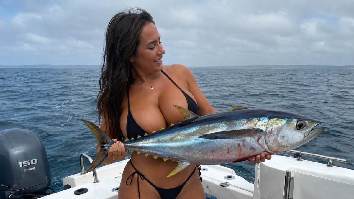
Heading out to fish for tuna is very different from heading to a rock you have marked on your GPS. When we look for bluefin, albacore, little tunny, skipjack, or yellowfin, we head out into an apparently empty ocean after fish capable of traveling enormous distances.
Tunas are highly migratory species. They can travel hundreds or thousands of miles following water masses, food, and reproductive cycles. The NOAA includes tunas among highly migratory species precisely because of these long-distance movements, which even cross international borders. This might make us think that saving a GPS point where we found fish is of little use, but in reality, the exact opposite is true. The fish moves, but the reasons why it was there can repeat themselves.
A specific temperature, a current, a convergence zone, an underwater structure, concentrated bait, working birds, or specific weather conditions can turn an apparently empty stretch of sea into a feeding zone. Therefore, when we find tuna, we shouldn't just save a catch; we should save where it happened, when it happened, and under what conditions it happened. And this is where CAPTA can completely transform the way we build our offshore fishing log.
Tunas: machines designed to roam the ocean
Tunas are some of the most extraordinary fish we can find in the open ocean. Their hydrodynamic body, powerful musculature, and physiology are adapted to maintain high speeds and cover enormous distances. The albacore (Thunnus alalunga), for example, is a highly migratory species distributed throughout tropical and temperate waters of the Atlantic, Pacific, and Indian Oceans. NOAA also points out that it feeds on fish, crustaceans, and squid.
The yellowfin (Thunnus albacares) also exhibits large oceanic movements and can cross huge expanses of sea. It is a predator that consumes fish, squid, and crustaceans and typically occupies tropical and subtropical waters. And that combination of mobility, speed, and constant need for food defines a large part of fishing for them. We are not just looking for fish, we are looking for an ocean that is gathering the necessary conditions for those fish to be there.
The big problem with offshore fishing: the sea seems completely empty
In coastal fishing we have obvious visual references: a point, a rock, a drop-off, a seagrass meadow, or a wreck. In offshore fishing we can find ourselves navigating over hundreds of feet of water without any visual reference. That is why a very common mistake consists of navigating miles hoping to find fish by chance.
The offshore angler progressively learns to read other signs. Water temperature, color changes, currents, foam lines, floating debris, seabirds, baitfish, surface activity, or sudden depth changes can provide vital information. And when several signs coincide, we have something much more interesting than simple coordinates: we have a pattern.
Food is the first clue
A tuna is not in a specific area because it likes the coordinate, it is there because there is a reason, and one of the most important is food. Tunas are opportunistic predators and a concentration of small fish, cephalopods, or crustaceans can trigger a feeding frenzy. NOAA describes tunas precisely as fast visual predators that consume a varied diet. That is why many times the best clues are not found by looking at the GPS, but by observing our surroundings:
- Bird activity: A group of birds repeatedly diving over an area deserves our full attention.
- Baitfish: A small fish jumping abnormally on the surface.
- Water patches: A dark patch moving under the surface can be a school of bait.
- Other predators: Even several concentrated dolphins can indicate that there is food underneath.
The key is to learn to distinguish an isolated observation from a situation that deserves to be investigated. And when we find that activity, it is advisable to immediately save the position.
Offshore trolling: covering water until finding activity
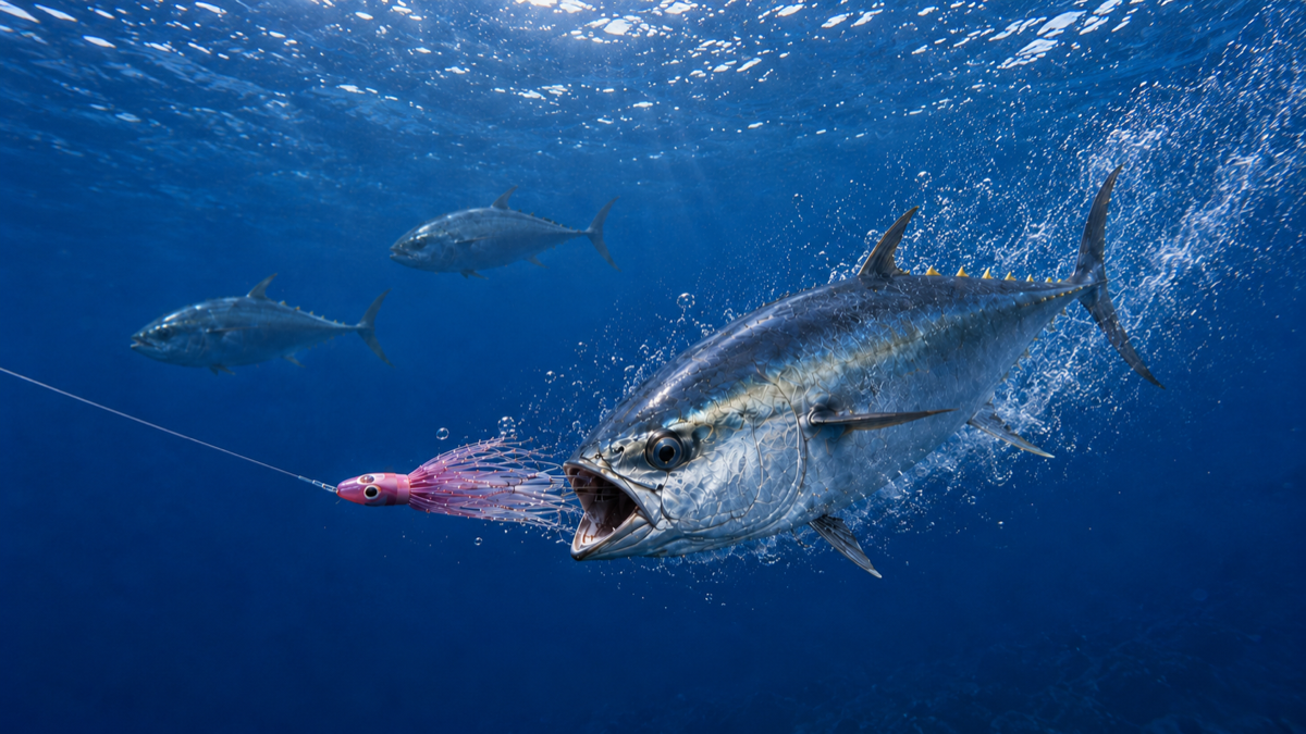
One of the most widely used techniques from recreational boats to locate tuna is trolling. The principle is simple: we deploy several lures behind the boat while we cover large extensions of water. FAO describes trolling as fishing by means of several lines with baits or lures towed, a technique particularly associated with albacore fishing and other pelagic species.
But placing four rods behind the boat and starting to navigate does not automatically turn a day into a strategy. The arrangement of the lines, the speed, the lures and, above all, where we pass matter decisively.
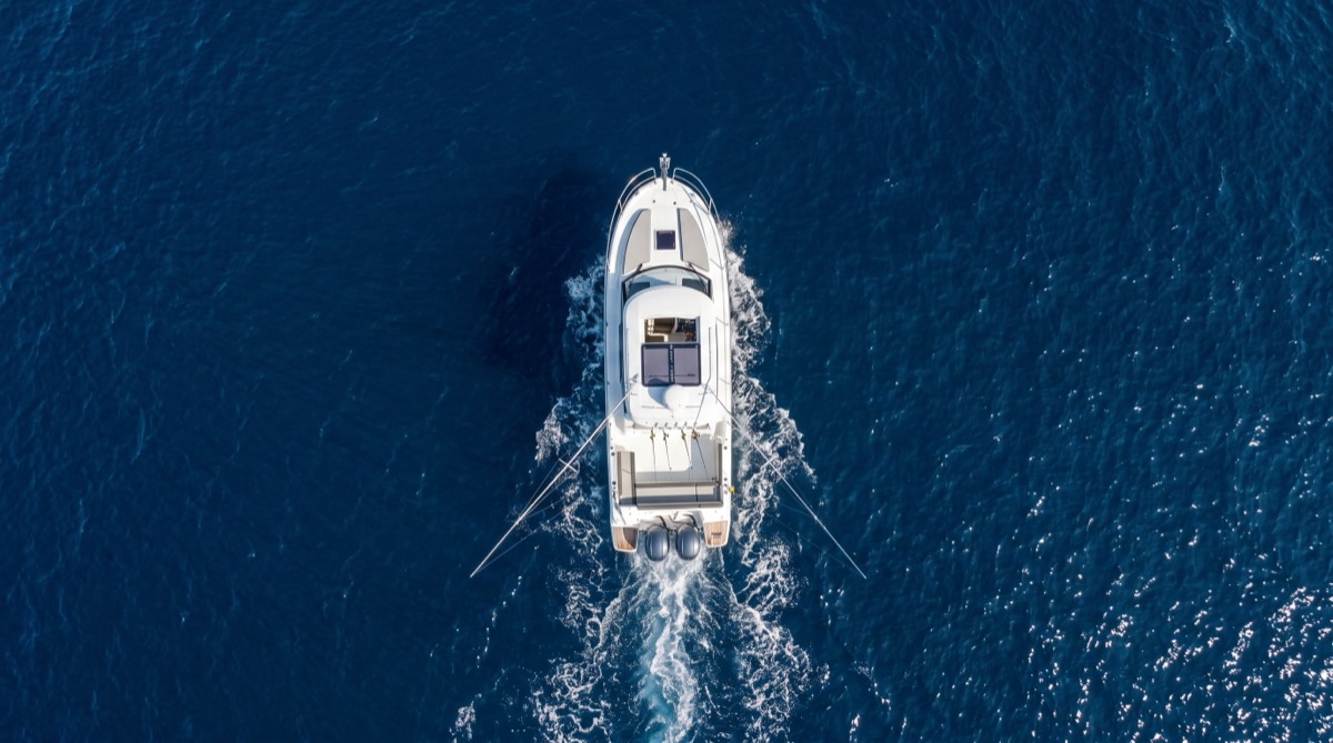
From above, the concept is perfectly understood. Each lure occupies a different position within the boat's wake. The goal is to cover a wide area and present different stimuli until discovering what is triggering the attacks.
How to organize trolling lines
With four rods we can create a simple but very effective distribution. Two lures can work relatively far from the boat and another two occupy different positions inside or around the wake. There is no universal distance that always works; the sea state, the target species, the speed, the type of lure, and the behavior of the fish will determine which configuration is best.
And here appears a very important idea: when something works, you have to record it. If we have a significant strike, we shouldn't just celebrate the catch. We can ask ourselves what lure got hit, at what distance, speed, depth, how the sea was, the temperature, and if there were birds or bait in the area. The more trips we log, the easier it will be to stop relying exclusively on intuition.
The moment of the strike: when everything changes in seconds
Few situations represent offshore fishing better than hearing a reel start pulling line at high speed. The boat has perhaps been navigating for an hour, nothing happens, and suddenly a rod bends and the reel starts screaming. We have a fish on, but that moment contains much more information than it seems.
Under the boat something much bigger could be happening. The fish that attacked could be part of a school, there could be a bait ball underneath, or we could be crossing exactly the edge of a current where food is concentrated. That is why the exact position of the first strike is extremely valuable and, at the same time, very easy to lose. While the crew works the rods, the boat keeps moving, and five minutes later we can be hundreds of yards away.
Save the strike before starting to search again
Here CAPTA becomes an essential tool. As soon as we have a strike we can quickly save a waypoint from our mobile phone, for example: "Albacore – trolling – first strike". We already have an exact reference, and when we finish the fight we can return directly to that position.
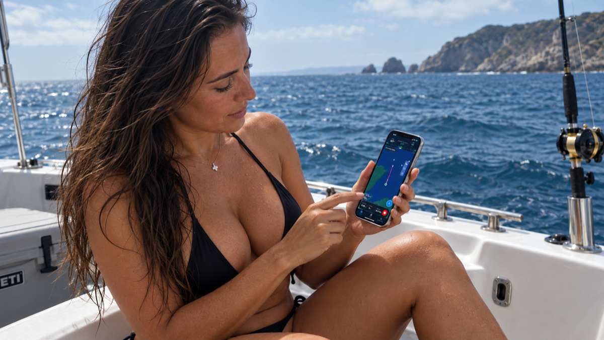
Instead of describing circles trying to remember where the strike occurred, we can navigate back to the point and reconstruct the pass. This is especially interesting when we get several strikes within the same area, because then it is no longer a coincidence: we are starting to delimit an activity zone.
Don't save a single point: build the zone
Suppose we have a strike and save the point. We pass by again and, 300 yards later, we have another catch. We make a third pass and activity occurs again. Now we have three positions, and if we observe them on the map we can start to discover invisible patterns from the boat: maybe they follow the same direction, they concentrate on a depth change, they travel the edge of a current or the fish is moving.
Saving multiple catches correctly ends up having much more value than accumulating waypoints without information, since we are building our own map of fish behavior.
The catch is the end of the fight, but the beginning of the information
Managing to land a good albacore or any other tuna on board is the moment we will remember, but from the point of view of our fishing log, we still need to save what just happened.
We can log the waypoint and add valuable notes in CAPTA:
- Albacore trolling with pink octopus.
- Strike at 08:42 AM.
- Lots of bird activity and bait ball observed.
But CAPTA adds an even more interesting layer: environmental conditions. Six months later we will remember the fish, but not the wind, the pressure, the swell, or the exact conditions. That information is precisely what we will be interested in comparing in the future.
A tuna waypoint does not mean "there are tunas here"
Tunas are highly migratory animals, so we cannot interpret a waypoint like a fixed rock. The point does not mean "there are always tunas here", but "something happened here under these conditions". That difference completely changes the utility of the GPS. If you return a month later and the ocean is empty, it does not invalidate the point. The truly interesting thing appears when the next season begins.
When the next year arrives, the true value of the log begins
Let's imagine that during one season we log 15 trips with dozens of strikes, dates, times, and conditions. When the next season arrives, we won't start from zero anymore. We will be able to consult our history in CAPTA and ask ourselves where we found fish last year, which areas produced several strikes, and what conditions repeated themselves.
And when CAPTA detects that similar conditions to those associated with our spots are approaching again, its alerts will help us identify when it is worth paying attention to those areas again. It doesn't mean it knows where the tuna is, but it helps us remember when the conditions are similar to those in which we ourselves found fish.
From an isolated strike to our own fishing pattern
One catch is an anecdote, five are data, and fifty start to tell a story. Maybe we discover that an area produces albacore in specific weeks, that the strikes concentrate with a certain wind, or that we follow the same corridor every season. CAPTA allows us to gather all that knowledge around the places where it actually happened, replacing fragile memory, lost photos, or WhatsApp messages.
Even if you have a chartplotter, save your best offshore zones in CAPTA
In offshore fishing the chartplotter is fundamental and it's not about replacing it, but about preventing your knowledge from depending on it. Changing boats, chartplotters, suffering a breakdown, or selling the vessel can complicate access to years of waypoints. Keeping a copy in CAPTA, with the ability to import and export GPX files, ensures that your history is always organized and safe on your mobile.
A complete strategy for offshore tuna trolling
If we put the whole process together, our day can follow a very clear strategy:
- We review the conditions before heading out.
- We navigate to historically productive zones.
- We look for signs of activity: birds, bait, currents, or jumps.
- We deploy the trolling lines trying different distances and lures.
- We immediately save the GPS point at the first strike.
- We finish the fight, log the catch in CAPTA, and return to the waypoint.
- We repeat the pass to delimit the activity zone.
- We keep the weather conditions associated with the trip for the next season.
In this way, we stop having a map full of random points and we start building our own offshore fishing map.
CAPTA: remember what the ocean tries to teach you
In tuna fishing we can travel dozens of miles to find a few minutes of activity, that's why those minutes are so valuable. One strike tells us something, several teach us patterns that memory alone cannot retain.
CAPTA allows you to save your private points, navigate back to them, and keep the conditions of your trips. The goal is not to tell you where the fish are, but to ensure you never lose what you yourself have learned finding them. The next time a reel starts screaming in the middle of the ocean, don't just save the memory: save the point, the conditions, and build your history.
Frequently Asked Questions (FAQ)
What tunas can be caught trolling?
The offshore trolling technique is extraordinarily versatile and allows catching practically any pelagic species depending on the region and the season. In the Mediterranean and Atlantic, it is common to look for species like albacore (Thunnus alalunga), little tunny, skipjack, and even large bluefin and yellowfin tunas. The key to success lies in adapting the boat's speed and the size of the lures to the target species. If you log your catches in CAPTA, over time you will be able to predict at what exact time of year it is most likely to find each species in your navigation areas.
What is offshore trolling and how is it practiced?
Offshore trolling consists of navigating offshore towing several lines with lures or baits behind the boat to cover large expanses of water. The main objective is to locate pelagic fish that constantly move hunting in the vastness of the ocean. The lines are usually placed at different distances and depths to create an attractive trail that simulates a school of fleeing fish. Saving the exact conditions of your successful passes in CAPTA will help you perfect this technique season after season.
Where to look for tunas in the open sea?
Rather than blindly searching for a specific coordinate, in the open sea it is advisable to observe visual signals that indicate a high concentration of food. A group of birds diving on the surface, bait desperately jumping, or sudden changes in water temperature are clear indicators that predators are near. Tunas travel huge distances looking precisely for these feeding conditions. By using an application like CAPTA to log these environmental observations, you will begin to understand why fish choose certain areas.
Why save the exact GPS point of a strike?
During the intense fight involved in catching a large tuna, the boat can drift hundreds of yards dragged by the current or the fish itself. Saving the position immediately at the moment of the strike allows you to return to the exact place where the attack occurred. This maneuver is vital to reconstruct the pass and make the most of the school of fish before it moves or disappears. CAPTA allows you to create this waypoint quickly from your mobile without losing attention on the rods.
Is a waypoint useful if tunas are migratory fish?
Yes, but it is necessary to interpret it correctly. An offshore fishing waypoint is not a guarantee of always finding fish in that exact geographic spot, but a record that there was activity there under certain conditions. This allows you to compare different trips, analyze the impact of the weather, the wind, and the ocean currents. By building your own fishing history with CAPTA, you will stop chasing empty coordinates and start looking for the right environmental patterns.
What information should be saved after a catch?
In addition to the exact coordinates and the species caught, it is essential to log the time of the strike, the type and color of the lure used, and any relevant observation such as the presence of birds, dolphins, or the sea state. All these small details form the recipe for success in offshore fishing. By associating this data with the atmospheric conditions that CAPTA automatically records, you will obtain invaluable information for planning your future sea trips.
Is it worth using CAPTA if I already have a good chartplotter on the boat?
Absolutely yes. CAPTA does not seek to replace your boat's navigation electronics, but to act as a smart database and a backup for your fishing knowledge. By keeping your important points independent of the boat's physical equipment, you can consult them, organize them, and plan trips from the comfort of your home with your mobile. Furthermore, GPX file compatibility makes transferring points between devices a quick and safe process.
Can CAPTA tell me where the tunas will be this weekend?
No. CAPTA does not magically predict the location of fish schools nor does it work like a real-time radar. Its true value lies in helping you return to specific positions and compare future forecasts with the weather and sea situations that gave you success in the past. It is a tool designed to enhance the angler's experience and instinct, helping you make better decisions based on your own catch history.