How to fish for John Dory with live bait | Complete guide
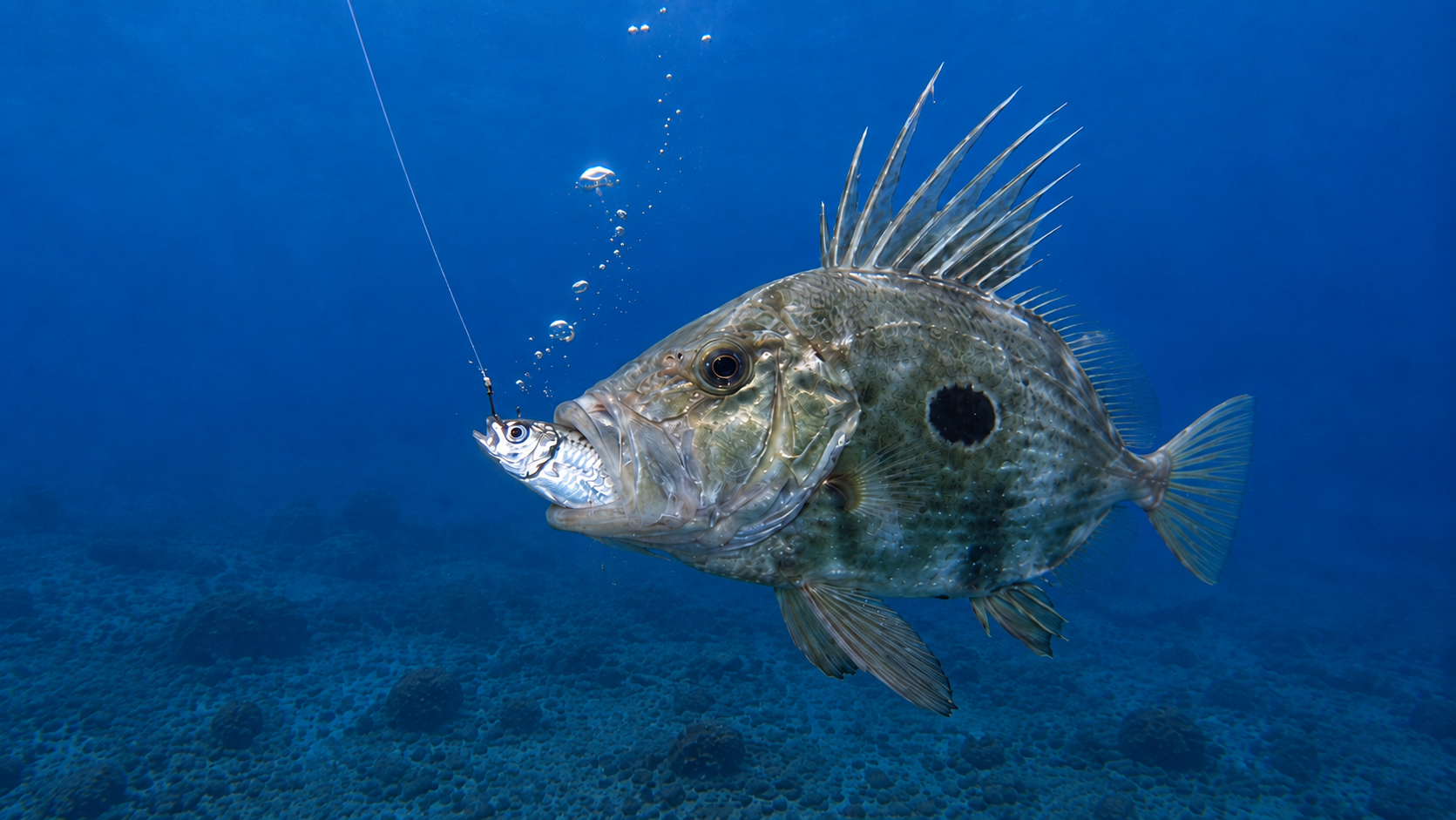
The John Dory (Zeus faber) is one of those fish that turns an ordinary fishing trip into something hard to forget. Its huge lateral profile, the characteristic dark spot on its flanks, and its long dorsal spines make it virtually impossible to confuse with any other species in the Mediterranean. But finding and catching it consistently is another story.
Fishing for John Dory is rarely about trolling for miles waiting for one to appear. It is a type of fishing where location, depth, food, and precision carry a lot of weight. And one of the most effective techniques is using live horse mackerel (scad), previously caught with a sabiki rig. This introduces a factor that many anglers overlook: before looking for the John Dory, we have to find its food.
And when we locate a productive school of horse mackerel, saving that spot correctly can be just as important as the catch itself. In this guide, we will see how to fish for John Dory with live bait, how to locate horse mackerel, how to properly use a sabiki, how to present the bait, and how to use CAPTA to save the GPS waypoints and fishing conditions that will allow us to repeat a great trip in the future.
The John Dory: A predator built to ambush
The John Dory is a very particular predator. Unlike extremely fast pelagic species like the amberjack, its strategy does not necessarily consist of chasing over long distances. Its extremely laterally compressed body allows it to approach its prey with a reduced profile before launching a rapid attack. Its enormous protrusible mouth is one of its main weapons; when it decides to attack, it can project it forward and generate a strong suction capable of engulfing small fish in a fraction of a second.
Among its prey, we find small benthic and pelagic fish, and precisely for this reason, a properly presented live horse mackerel can be extraordinarily attractive. For the angler, this has an important consequence: it is not enough to have good bait. You have to get that bait to pass exactly through the area where the John Dory is hunting. And this is where the strategy really begins.
Step 1: Finding the schools of horse mackerel
Before looking for the John Dory, we need to get live bait, and the horse mackerel is one of the best options. On many days, horse mackerel appear grouped together, forming relatively compact schools. The fish finder (sonar) can be a fundamental tool for detecting them, especially when they are suspended off the bottom.
When we find activity, we shouldn't just think "There are horse mackerel here". The really interesting question is: "Will I be able to find this school or this area again?". Fish move, obviously, but certain bottom features, depth changes, structures, currents, or areas where food concentrates can produce recurring activity.
Therefore, when we find an area where we can easily catch horse mackerel, it is worth immediately saving the GPS point. This is where CAPTA becomes part of the strategy. We can create a specific waypoint, for example, Horse mackerel school – live bait, and keep that position for future trips. We are not just saving where we saw some fish on a specific day. We are building our own map of productive zones.
How to fish for horse mackerel with a sabiki correctly
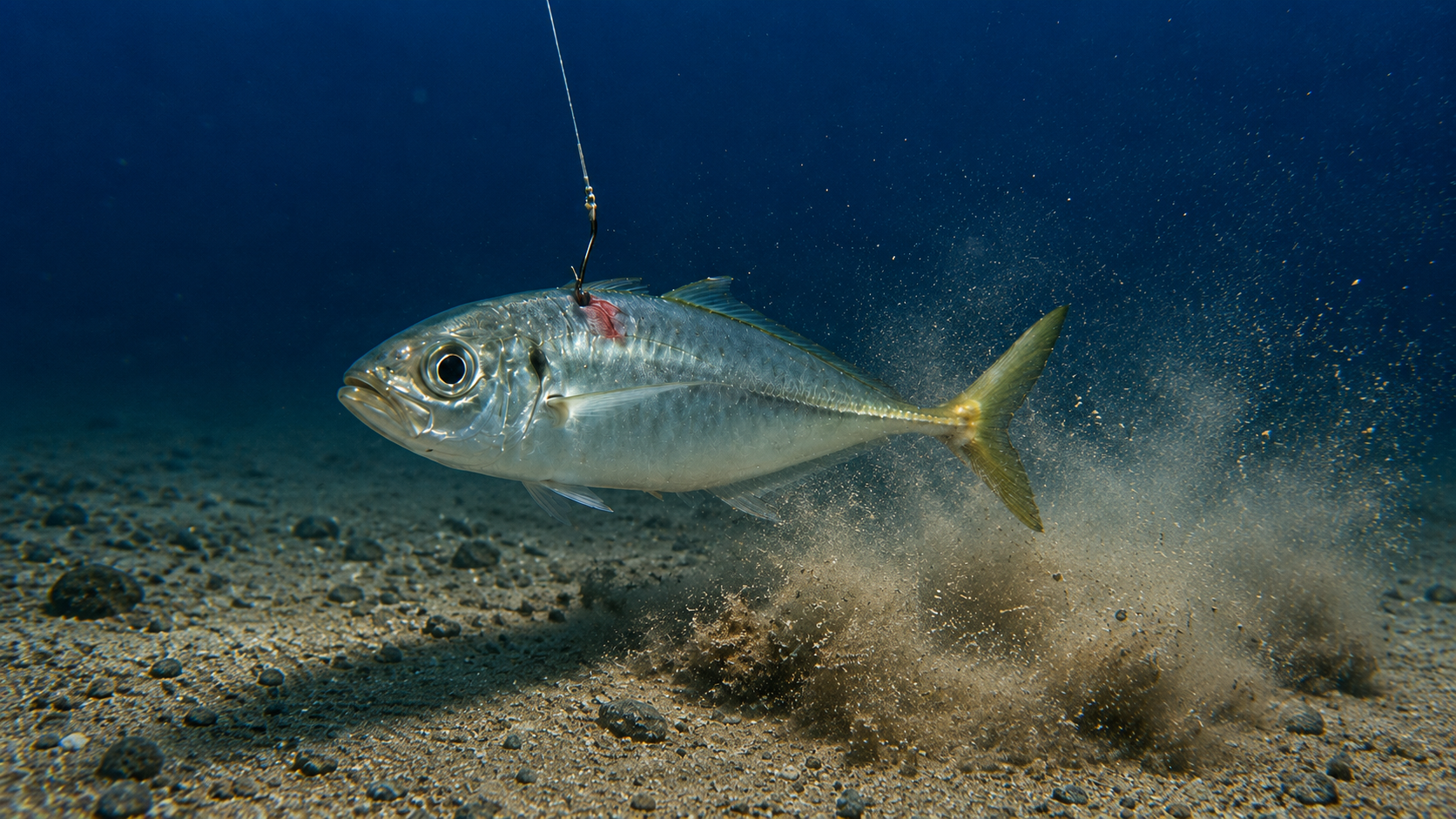
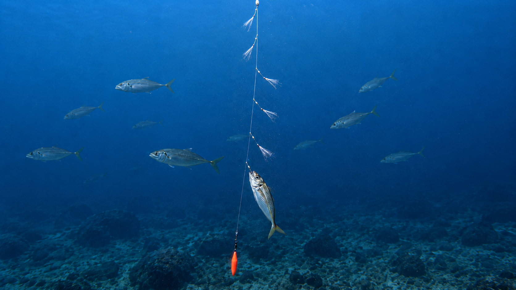
Once the school is located, one of the fastest ways to catch horse mackerel is by using a sabiki. The sabiki consists of a main line from which several small branch lines with hooks decorated with fibers, fish skin, reflective materials, or imitations of small organisms emerge. At the bottom, we attach a sinker that allows us to quickly reach the desired depth. Although it seems like a simple technique, there is a huge difference between dropping a sabiki without control and using it correctly.
The key is knowing at what depth the school is located. If the sonar indicates activity, for example, suspended several meters above the bottom, it makes no sense to constantly let the rig drop until it hits the seabed. We can lower it to the layer where the fish appear and work the sabiki there using short, controlled movements. The goal is not to make violent jerks; small lifts of the rod make the branch lines come to life and simulate small suspended prey in the water.
When the first horse mackerel strikes, the movement of the hooked fish can even increase the attractiveness of the rig and bring in more fish. But if our goal is to get quality live bait, we do not need to fill all the hooks. We need healthy horse mackerel.
The horse mackerel must arrive alive and strong
This point is fundamental. Catching a horse mackerel does not automatically mean having good live bait. The less we handle it, the better. If we have a livewell, we must introduce it quickly and maintain proper water renewal or oxygenation. The goal is for the fish to retain all its swimming capacity.
A weakened horse mackerel is still bait, but a strong horse mackerel is prey. And for a predator like the John Dory, the difference can be considerable. It is also advisable to use specimens of a reasonable size in relation to the fish we are targeting and our tackle.
Step 2: Finding the John Dory zone
With the bait ready, the second part of the trip begins: now we need to find the predator. The John Dory can be found over different types of bottoms and depths depending on the area, season, and food availability. For this reason, it is much more interesting to create your own catch history than to rely exclusively on general recommendations.
An isolated catch could be a fluke, but several catches around certain structures, depths, or conditions begin to form a pattern. That is why every John Dory caught should become information. When we get a bite or land a catch, we can immediately save the waypoint in CAPTA. For example: John Dory – live horse mackerel – 62 m.
That point can store more than just coordinates. CAPTA allows you to associate the location with information about the trip and consult the conditions that accompanied that catch, so that over time we stop having a collection of dots and start having an authentic fishing logbook. And that completely changes how we interpret our spots.
Fishing for John Dory with live horse mackerel
Once positioned over an interesting area, we can drop the live horse mackerel. The rig can vary depending on depth, current, and bottom type, but the principle is always the same: presenting a live fish naturally in the John Dory's hunting zone. The rig must allow the horse mackerel to retain mobility. Excessive weight, disproportionate hooks, or a rig that is too stiff can eliminate exactly what makes live bait effective: its behavior.
We must also adapt the sinker to the conditions. We need enough weight to control the line and reach the desired area, but no more than necessary. In significant depths or with drift, keeping the rig within the productive zone can become one of the main challenges. And a few meters can matter much more than it seems.
The John Dory bite: you don't always have to react immediately
When a John Dory finds the horse mackerel, the bite can be different from that of other large predators. We have a fish with a huge mouth capable of engulfing prey through suction. Therefore, we must avoid automatically interpreting any contact as a signal to make an aggressive hookset.
Depending on the rig used, we must allow the fish to properly take the bait before progressively applying tension. The choice of hook is also important: it must have enough strength to handle a good-sized fish, but without being so heavy that it impairs the natural movement of the horse mackerel.
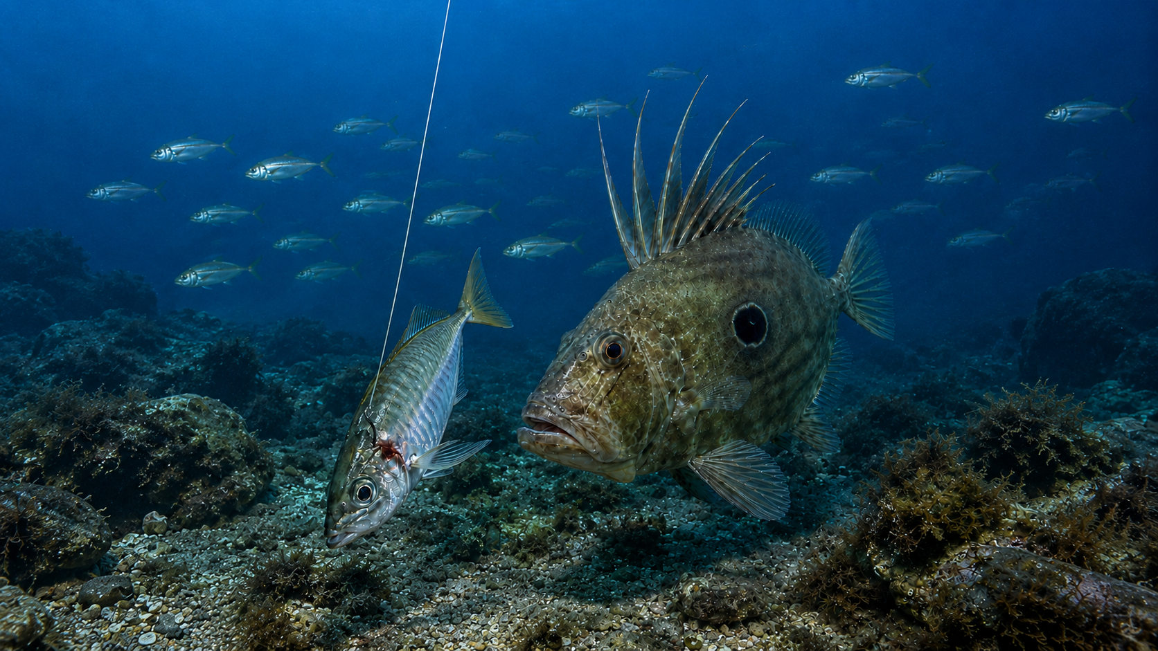
This image perfectly represents what we are trying to achieve under the boat: a horse mackerel moving within the correct zone and a John Dory approaching to attack.
The exact position matters more than it seems
Here we find one of the biggest differences between fishing an area and fishing a specific spot. We might know that there are John Dorys in a certain area, but that does not mean that the entire expanse has the same productivity. There might be a small rock, a bottom transition, a ledge, a depression, or a structure around which the activity is concentrated. Passing 20 meters away could mean not getting a single bite. That is why we use GPS and a chartplotter.
But there is another problem: the waypoints we accumulate over the years can become one of our most valuable fishing assets. Losing them by changing devices, suffering a breakdown, selling a boat, or simply not remembering where a point was stored means losing years of knowledge. That is why it makes sense to keep an independent backup of our best spots in CAPTA.
Even if you use the boat's or kayak's GPS plotter, you can also save the important points in CAPTA and keep them organized on your phone. Importing and exporting via GPX also allows you to move your points between devices much more easily. Your fishing knowledge no longer depends on a single device.
Don't just save the spot: save the conditions
This is probably one of the most interesting parts of building a fishing history. Let's imagine we catch a good John Dory. We save the coordinates. Perfect. But six months later we return to the exact same point and absolutely nothing happens. Does that mean the waypoint is no longer any good? Not necessarily.
The position only represents one part of the equation. The conditions of that day can also have an influence: wind, swell, atmospheric pressure, temperature, moon phase, tides, and other environmental factors. CAPTA allows you to link your spots and trips with the fishing conditions, so you can start answering much more interesting questions: What were the conditions when this spot worked? And even better: When will similar conditions occur again?
CAPTA can help you detect when conditions start looking like those of previous successful trips. You are no longer just looking at a generic forecast. You are comparing the future with your own catch history. And that is especially powerful when you have been fishing the same areas for months or years.
From waypoint to fishing pattern
Suppose that during a season you catch several John Dorys. One at 58 meters. Another at 62. Another on the same rock a few weeks later. You save each catch and its conditions. Over time, you may start to discover that certain areas work better under specific circumstances.
That is information that previously remained scattered between memory, mobile phone photos, sonar screenshots, and waypoints without descriptions. CAPTA allows you to centralize it. The goal is not to replace the angler's experience, but to prevent that experience from being lost. Because a good fishing trip contains information, and if we don't save it, the following year we practically start from scratch.
A complete strategy for fishing John Dory
If we put the whole process together, the strategy is very clear:
- We locate horse mackerel activity with the sonar.
- We save in CAPTA the areas where we regularly find schools.
- We lower the sabiki to the exact depth of the school.
- We catch one or more horse mackerel, taking care to keep them in perfect condition.
- We move to our John Dory spots.
- We lower the live horse mackerel to the appropriate depth.
- We control the drift to keep the bait within the productive zone.
- When we land a catch, we immediately save the waypoint.
- We record the conditions of that trip.
- We use that history to decide when it is worth returning.
This way of fishing completely transforms the concept of a waypoint. We no longer just have: "I caught a John Dory here." We have: "I caught a John Dory here, with this bait, at this depth, and under these conditions." That is infinitely more valuable.
CAPTA: Turn your catches into information for the next trip
The best anglers usually accumulate years of information. They know where they found horse mackerel, they remember that rock where the John Dorys bit, and they know an area where fish appear during certain seasons. The problem is that a large part of that information ends up relying on memory, and CAPTA was born precisely to prevent that.
You can save your private fishing spots, organize them, navigate back to them, import and export GPX, and keep your spots regardless of the plotter you use. And when we add the fishing conditions, the waypoint ceases to be just a coordinate; it becomes a record of what happened. For a type of fishing like the John Dory, where locating the food and correctly repeating certain areas can make the difference, having that history makes a lot of sense.
Your best spots shouldn't depend on you remembering where you fished a year ago. Save them, protect them, and go back when the conditions look good again. Download CAPTA and start building your own private fishing map.
Frequently Asked Questions (FAQ)
What is the best bait for John Dory fishing?
The John Dory is a predator that consumes fish, so live bait can be especially effective. Live horse mackerel (scad) is a very interesting option due to its mobility and hardiness. The important thing is to keep it in good condition and present it naturally near the area where the John Dory is located.
How to get live horse mackerel for fishing?
One of the most practical techniques is to previously locate a school using the fish finder (sonar) and use a sabiki rig. We must work the rig at the depth where the fish appear instead of automatically dropping it to the bottom. Once the horse mackerel is caught, it should be handled as little as possible and kept properly oxygenated.
Where do you fish for John Dory?
It can be found at different depths and bottom types depending on the area and the season. Rather than relying on a universal depth, it is especially useful to save the waypoints where we have landed catches and analyze which structures and depths are repeated using a specialized GPS app like CAPTA.
Why save the horse mackerel schools in the GPS?
Because some areas concentrate horse mackerel on a recurring basis. Saving them allows you to start future trips by first visiting our historic bait spots instead of searching from scratch. In CAPTA we can keep these waypoints organized and separated from our regular catch spots.
Is it worth saving a spot if I already have a chartplotter on the boat?
Yes. The chartplotter continues to be a fundamental navigation tool, but keeping our best spots in CAPTA as well creates an independent backup accessible from your mobile phone. In addition, the ability to import and export GPX files makes it much easier to securely transfer waypoints between devices.
Why save the conditions of a catch?
Because a coordinate tells us where, but not necessarily why it worked that day. Linking our catches to environmental conditions (wind, atmospheric pressure, tide) allows us to build a history and compare future trips with situations that previously produced good results.