How to Read GPS Coordinates
Complete Guide to Technical Precision and Protocols
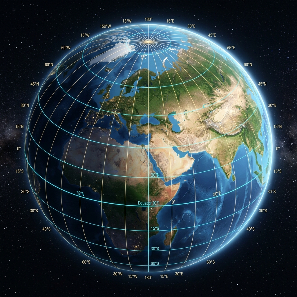
The Foundations of the System: Latitude and Longitude
Reading a GPS coordinate is, in essence, reading an address on a giant sphere. However, the Earth is not a perfect sphere, but a geoid flattened at the poles. This subtle difference is what separates an amateur from a professional navigator.
Latitude measures the angular distance north or south of the Equator. Its values range from 0° at the Equator to 90° (North or South) at the poles. Longitude, on the other hand, measures the distance east or west of the Greenwich meridian (the Prime Meridian). Its values range from 0° to 180°. Together, these two values create a mathematical grid that allows any object on the Earth's surface to be located with staggering precision.
The Anatomy of a Degree: From Geometry to Reality
A common mistake is thinking that a degree represents a fixed distance. It does not. While a degree of latitude always equals approximately 111 kilometers (regardless of where you are), degrees of longitude "narrow" as you move away from the Equator. At the poles, the distance between two longitude lines is zero.
This concept, known as meridian convergence, is vital to understanding why coordinate reading requires high-precision formats. When we read a coordinate, every decimal we add after the point is not just "one more number"; it is an exponential reduction in the search area.
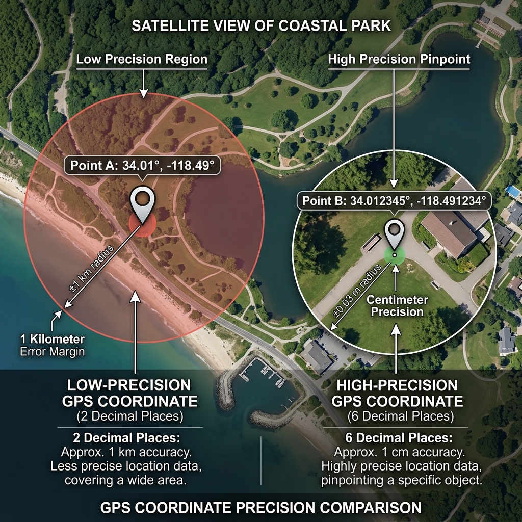
Precision Scale: What do those decimals really mean?
For CAPTA users, understanding resolution is fundamental. Let's see what happens in the real world when we read decimals in Decimal Degrees (DD) format:
- 1st Decimal: ~11 kilometers precision (City level).
- 3rd Decimal: ~110 meters precision (Block level).
- 5th Decimal: ~1.1 meters precision (Professional level, perfect for fishing or hiking).
- 7th Decimal: ~1.1 centimeters precision (Scientific and advanced surveying level).
Omitting or misreading the fifth decimal can mean that instead of being over a wreck or a specific point of interest, you are several meters away, losing the asset completely.
Professional Coordinate Communication Protocols
In rescue missions, technical navigation, or field work in a team, reading is not just for yourself, but to communicate to others. A reading error over the radio can be fatal.
Voice Communication Standard (NATO Protocol):
- Order: Latitude must always be read first, followed by Longitude.
- Reference: Use the cardinal direction (North, South, East, West) instead of positive or negative signs to avoid confusion.
- Phonetic: Read numbers digit by digit. For example: "Latitude Four-One-Point-Four-Zero..." instead of "Latitude Forty-one point forty...".
This level of discipline in reading ensures that information is transmitted unambiguously, eliminating the risk of the receiver entering erroneous data into their equipment.
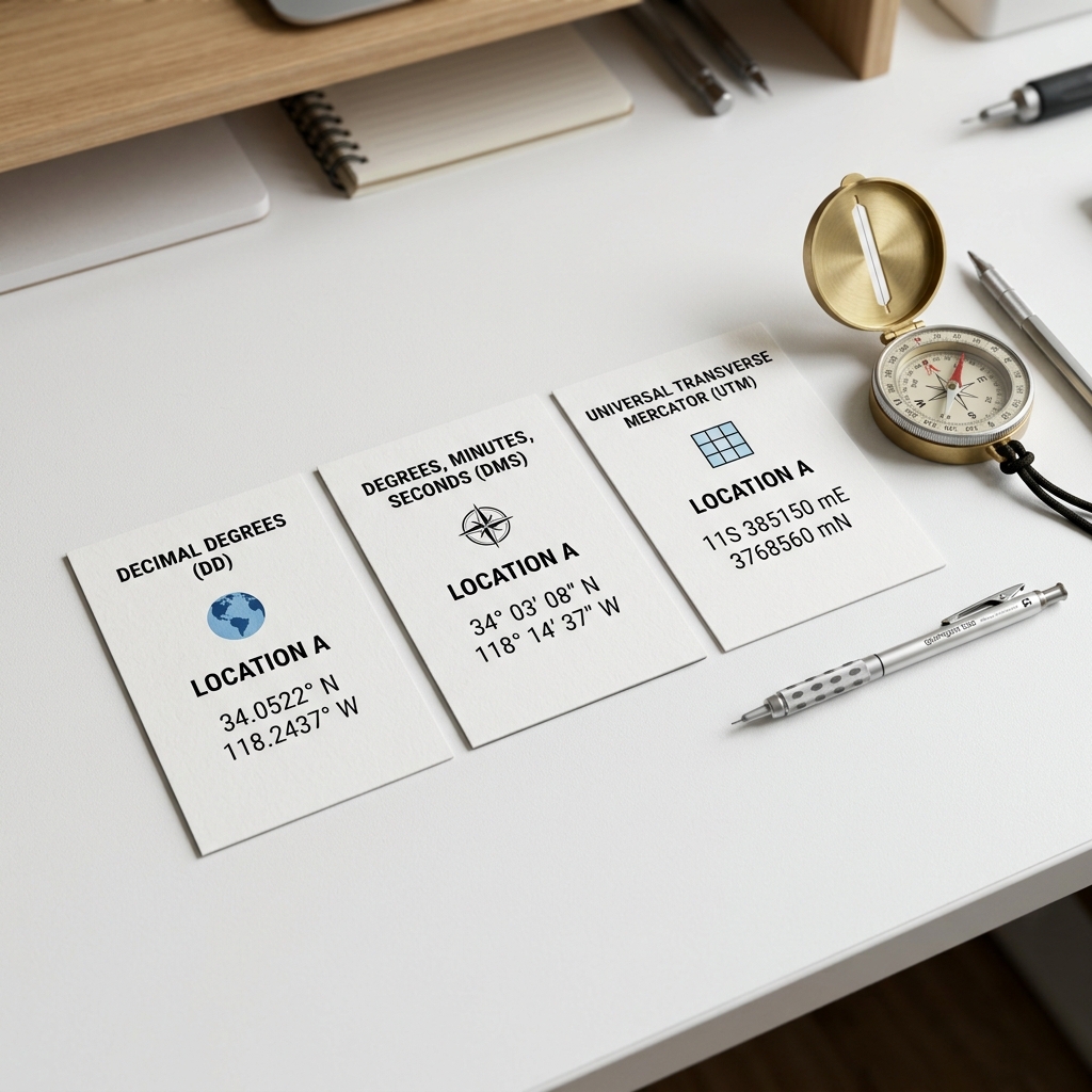
Systems and Formats: A Geographic Tower of Babel
Although digital systems prefer Decimal Degrees (DD), in your professional life, you will encounter three dominant formats that you must know how to read and interpret:
1. Decimal Degrees (DD)
Example: 41.40338, 2.17403. It is the native language of CAPTA and Google Maps. It is the most efficient for data processing.
2. Degrees, Minutes, and Seconds (DMS)
Example: 41° 24' 12.2" N 2° 10' 26.5" E. It is the format of classic navigation and traditional surveying. It is very visual but complex to type manually without making mistakes.
3. UTM (Universal Transverse Mercator)
Example: 31T 430959 4583987. Unlike the previous ones, which are angular, UTM divides the earth into meters on a flat grid. It is the standard in civil engineering and military work.
The Problem of the Datum: The Context of the Reading
It is not enough to read the numbers; you must know in what "language" they are written. That language is the Datum. The most common Datum today is WGS84, used by the global GPS system. However, if you are reading a coordinate on an old paper map that uses a local Datum (like ED50 in Europe), even if the numbers are correct, your real point will be displaced by up to 200 meters.
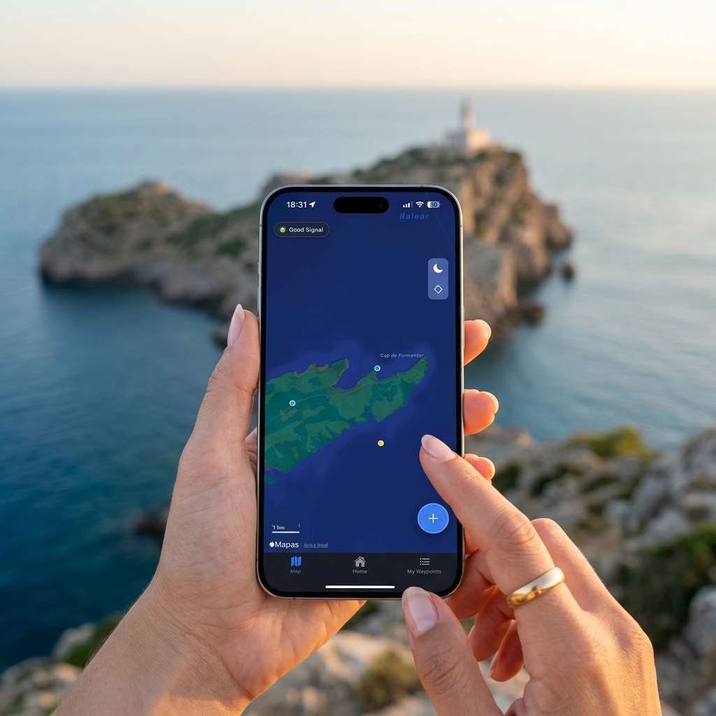
The Revolution of Automatic Reading
Despite all the technical knowledge, the human factor remains the weakest link. Reading a coordinate on a small screen under bright sun, amidst salt spray or wind, and then trying to remember it to note it down, is a task doomed to failure.
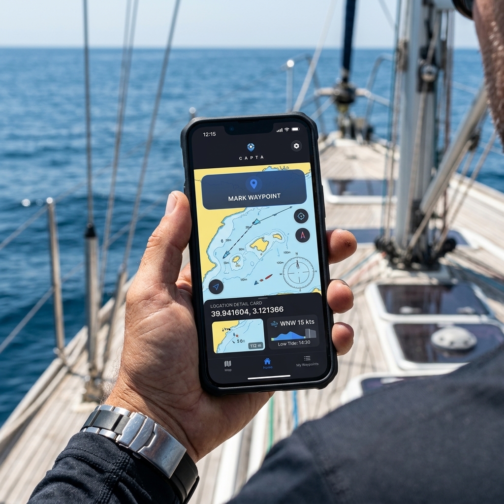
That's why at CAPTA we've moved from "teaching to read" to "automating capture". When you use our app over a ship's plotter or a physical map, CAPTA doesn't just "read" the numbers for you through OCR, but validates them, assigns the correct Datum, and saves them immediately. By eliminating the visual-mental-manual step, the precision of your work rises to 100%.
FAQ: Frequently Asked Questions about Coordinate Reading (Faq)
Why is my longitude negative if I am in Europe?
The Greenwich Meridian crosses Europe. Any place west of that meridian will have a negative longitude or be marked as "West" (W). It is a common mistake to try to "correct" this sign, but it is vital to keep it. If you suspect the sign is the problem in a tiring manual reading, using CAPTA allows you to automatically detect the logical location based on your GNSS zone, eliminating the sign doubt at its root.
How many decimals should I read for the location to be "Exact"?
"Exactness" is relative to your activity. For general maritime navigation, 4 decimals are sufficient. However, to find a specific fishing spot or a geological sample, you need to read at least 5 or 6 decimals. CAPTA always captures and stores with the maximum resolution of the device's GPS sensor, ensuring you don't lose precision due to a superficial reading or hasty user rounding.
Can I read coordinates from a UTM system and pass them to my mobile directly?
Yes, but it requires a complex mathematical map projection conversion. Reading UTM involves knowing the Zone and the Band. Instead of doing error-prone manual calculations, you can use the CAPTA scanner which directly interprets the UTM nomenclature and instantly translates it into the system you need, allowing you to navigate to that point without mathematical complications.
What does the "N" or "S" symbol after the numbers mean?
They represent the Hemisphere: North or South with respect to the Equator. It is the most critical data after the numbers themselves. An error reading "S" instead of "N" would place you in the opposite hemisphere, thousands of kilometers away. That's why professional protocols require the letter to be read always at the end of each numerical block to uniquely confirm the global position.
How can I read coordinates if I don't have an internet signal?
Coordinates are pure mathematical data based on satellite signals; they do not depend on the internet. You can read them directly in your CAPTA application even on the high seas or in deep caves. The advantage of CAPTA is that by saving the visual capture along with the data, you have a real reference of what you were seeing at the time of reading, something that a traditional text note can never offer you.