Digitalizing Notebooks and Logbooks
Rescuing Geographical Memory
The Entropy of Paper: Why Your Analog Geodata is At Brain Risk
In the world of exploration, technical fishing, and precision hiking, there is an invisible yet extremely vulnerable heritage: the field notebook. For decades, professionals and enthusiasts alike have relied on the physical medium of paper and ink to record their most valuable findings. However, from a data engineering perspective, paper is a low-fidelity and very high-entropy storage medium.
Entropy, in this context, refers to the natural tendency of analog information to degrade and lose order over time. Humidity that swells cellulose fibers, ultraviolet radiation that breaks down ink pigments, or simply the difficulty of interpreting hasty handwriting in adverse field conditions turns these logs into what specialists call "zombie data": information that exists physically but is useless for operational navigation. Digitizing with CAPTA is not transcribing; it is performing an information archaeological rescue that transforms a fragile physical record into an immutable, georeferenced digital asset with guaranteed integrity.
The Science of Automatic Transcription: OCR Handwriting in CAPTA
To understand CAPTA's power, we must analyze the technical challenge posed by handwritten OCR (Optical Character Recognition). Unlike printed texts in standardized digital fonts, handwritten coordinates exhibit nearly infinite morphological variability. Each user has a different neural signature when tracing degree symbols (°), minutes ('), and decimal points.
High-Density Extraction Mechanics
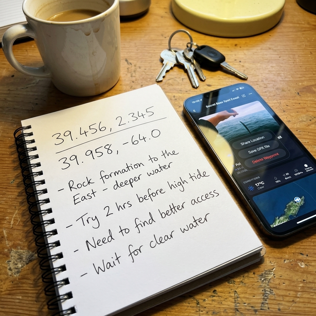
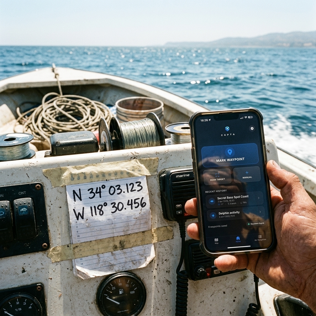
CAPTA's engine is not limited to simple character recognition. It uses layers of Computer Vision specifically trained for "Character Topography." The system analyzes the visual noise of the paper, segments numerical sequences, and validates the mathematical coherence of the coordinate before presenting it. If a "7" looks like a "1" due to a moisture stain, CAPTA's algorithm performs a geographic range validation to determine which digit is logical. This heuristic filtering process eliminates the most critical human error: transcription failure. A single incorrectly interpreted decimal point manually can shift your waypoint by hundreds of meters, completely invalidating the utility of a secret spot.
The "Datum Shift" Phenomenon: Why Your Old Notes Might Lie to You
A technical aspect that almost all explorers ignore is the shift in geodetic reference systems. If you have coordinates in a notebook from the 80s or 90s, they are very likely not calculated on the WGS84 system used by modern GPS. In many regions, the use of local Datums like ED50 or NAD27 was common.
The Importance of Digital Standardization
When you digitize your notebooks with CAPTA, the system acts as a geodetic unifier. By integrating that information into a modern digital environment, you can detect and correct "Datum Shift" errors. A point saved in an old Datum can appear shifted by up to 200 meters if viewed directly on Google Maps without correction. By passing those data through CAPTA's workflow, you force your information to align with the mathematical truth of today's satellites, transforming an imprecise historical note into a surgical navigation coordinate.
Data Sovereignty and the Public Cloud Trap
There is a dangerous tendency to use generic scanning applications (such as Google Lens or cloud recognition services) to process personal notes. The technical problem here is not precision, but Data Sovereignty.
Privacy by Design
When you process the image of your secret fishing notebook in a public cloud, those geodata feed massive indexing algorithms. Your "hotspots" cease to be exclusive. CAPTA is a solution designed under local-first security principles. The processing of your images for coordinate extraction is performed with maximum respect for technical privacy, ensuring that the knowledge you've accumulated over decades doesn't end up being part of a tech giant's commercial "big data." Your notebook digitized in CAPTA is impregnable.
Dynamic Enrichment: Injecting Intelligence into Legacy
A note on paper is a static entity (a dead record). By digitizing it with CAPTA, we turn it into a Live Waypoint (Active Waypoint). This transformation allows adding layers of intelligence that analog media simply do not support:
- Retroactive Atmospheric Metadata: By assigning the original date of the note to the digitized point, it's possible to cross-reference the waypoint with barometric pressure (hPa) and tide cycle history, identifying why that spot was so productive in 1995.
- Linked Media Management: You can associate current photos of the area's state to perform erosion studies or changes in submerged structures, linking the past of the paper with the digital present.
- Advanced Taxonomy and Structuring: Paper does not allow filters. CAPTA lets you organize 500 digitized points by "Species," "Season," or "Access Difficulty" in milliseconds.
Professional Interoperability: The Data Life Cycle in the GPX Workflow
For the serious explorer or angler, the smartphone is just the beginning of the command chain. Real digitization implies that those data can "travel."
CAPTA functions as a Universal Conversion Hub. Once you've released your coordinates from paper jail via our OCR scanner, you can export those data in GPX (GPS Exchange Format). This protocol is the Esperanto of nautical and terrestrial navigation. By having your notebooks digitized in this format, you can load them directly into nautical-grade equipment like Garmin, Lowrance, or Raymarine. You've converted a pile of damp, hard-to-read papers into a professional database ready to be navigated with the most advanced electronics on the market.

The Risk of "Bit Rot" vs. Paper Degradation
Many argue that paper is more durable than digital. Technically, this is only true if data integrity is not managed. CAPTA solves the longevity problem through Synchronization with Integrity. While paper burns, gets wet, or gets lost, your information in CAPTA lives in a redundant and encrypted environment.
Mass-digitizing your notebooks eliminates the Single Point of Failure of your personal information system. You no longer depend on "finding the blue 2012 notebook." All your accumulated geographic knowledge is indexed, searchable, and resistant to the passage of physical time.
FAQ: Frequently Asked Questions About Paper-to-Digital Migration (Faq)
What happens if the ink in the notebook is so degraded that it is barely visible?
CAPTA integrates image post-processing engines that act similarly to forensic restoration filters. The system raises the contrast threshold and reduces visual background noise (such as moisture or coffee stains) to try and isolate original ink strokes. While we cannot perform miracles with totally destroyed pages, our geodata recovery capability is infinitely superior to human sight, allowing the rescue of points you thought lost years ago. This technical recovery capability is what defines CAPTA as a professional-grade tool.
Can I scan pages that have coordinates written in different formats at once?
Absolutely. The algorithmic intelligence of our OCR engine automatically detects each line's syntax independently. If on the same page of your log you have annotations in Decimal Degrees (DD) mixed with classic Degrees, Minutes, Seconds (DMS) or Nautical (DDM) formats, CAPTA will identify each, process them according to their own mathematical rules, and unify them in the visualization system of your choice. You don't need to perform tedious manual conversions; the system does the heavy lifting of geodetic unification for you.
How does CAPTA guarantee my coordinates won't leak during scanning?
Our technical architecture prioritizes local processing. Unlike conventional tools that send every image to external servers for analysis, CAPTA's engine attempts to resolve data extraction with your own device's computing power. When cloud support is required for complex optimizations, data travel under end-to-end encryption protocols, ensuring that your strategic findings—whether exclusive fishing zones or tactical routes—remain under your absolute sovereignty and out of reach of third parties.
If I have hundreds of pages, do I have to create the points one by one?
CAPTA's workflow is designed for massive efficiency. Once the scanner identifies coordinates on a page, it allows for batch validation. You can assign a base name, technical category, and origin date globally for all detected points in a single scan. This transforms a task that once took weeks of manual transcription into a fluid process completed in minutes, letting you spend more time in the field or at sea and less time in front of the screen.
What format is most recommended for the final dump from the notebook?
From a technical interoperability standpoint, we always recommend dumping to Decimal Degrees (DD) format within CAPTA. However, the important thing is that the system allows you to keep the original notebook image linked to the digitized waypoint. This "Source Traceability" is vital: if you have doubts about a point in the future, you can always consult your notebook's original photo without having to physically locate the object. It's the security of having an unalterable visual backup linked to dynamic data.
Conclusion: The Angler/Explorer Who Masters Their Data, Masters the Terrain
Digitizing your notebooks is not an aesthetic whim; it is an informational survival necessity. In a world where access to precise information is the only real currency, leaving your geodata in the hands of a piece of paper is an unacceptable risk.
CAPTA not only offers you a tool to read numbers; it offers you a management ecosystem that grants your past experience the power of present-day technology. Your paper logs are the past; your CAPTA database is the future of your success.
Start rescuing your legacy today and transform your old notes into the ultimate map of your life.